Short essay on Water Transport system in India

Water transport is one of the oldest means of transport in India. Prior to the advent of rail and road transports, goods and people were moved from one place to another through water transport. Since there is almost very small cost involved in the construction and maintenance of waterways this transport system is always cheaper.
According to one estimate the construction of each km of railway and road needs an investment of Rs. 1.0-1.5 crores and Rs. 0.60-0.75 crore respectively whereas only Rs. 0.10 crore is required to develop same length of waterways. Their development is faster and maintenance cost much lower. Waterways are of two types: (a) Inland waterways, and (b) Sea ways or ocean ways also called shipping.
Inland Waterways
Inland waterways refer to using inland water bodies like rivers, canals, backwaters, creeks, etc for transporting goods and people from one place to another. India has a long historical tradition of using such waterways. Ganga, Brahmaputra, Indus, Yamuna, Mahanadi, Godavari, Krishna, Kaveri, Narmada and Tapi etc. were the main arteries of the country’s transport system giving birth to a number of inland river ports and jetties. The decline of river transport began with the construction of the railways during the middle of the 19th century.
ADVERTISEMENTS:
Later on the development of roads adversely affected the prospects of such transport. The diversion of river water irrigation canals made many of these rivers unsuitable for navigation,. So much so that today its share is only one per cent in the country’s transport system.
India is a land of many long and perennial rivers. But water transport is not very popular in the country. This is mainly due to seasonal concentration of rainfall, fluctuating river regime, devastating floods during rainy season, shifting river courses (in the Northern Plains) making it difficult to construct permanent jetty or wharf, diversion of large quantity of river water into irrigation canals so as to reduce the depth of water in the river and making it unsuitable for steamers and mechanised boats, heavy silting and formation of sandbars, undulating topography in hilly and plateau regions leading to the formation of a number of rapids, and formation of delta and diversion channels making the mouth narrower for the entry of ships and big boats.
The country has about 14,500 km of navigable waterways which comprises rivers, canals, backwaters, creeks, etc. Of this total length only a length of 3,700 km of major rivers is navigable by mechanised crafts but the length actually utilised is only 2,000 km. As regards canals, out of 4,300 km of navigation canals, only 900 km is suitable for navigation by mechanized crafts. About 160 lakh tonnes of cargo is annually moved by Indiand Wjjter Transport.
The most important waterways of the country are : the Ganga Bhagirathi Hugli, the Brahmaputra river , the Barak river, the delta and lower courses of the Mahanadi, Godavari and Krishna rivers, the lower courses of the Narmada and Tapi, the Zuari and Mandovi rivers in Goa, the Kali, Shravati and Netravati in Karnataka.
The backwaters and lagoons in Kerala and the Buckingham Canal of Andhra Pradesh and Tamil Nadu. Uttar Pradesh has the highest length of navigable inland waterways (2,441 km or 17.01 per cent) of the country followed by West Bengal, Andhra Pradesh, Assam, Kerala and Bihar (Table 25.IX).
1. The Ganga
The Ganga river provides an important inland waterway for the country. It is a perennial river fed by Monsoon rains during rainy season and melting of the snow during dry summer days. On its 2,510 km length from snow to the sea it passes through most densely populated parts of the country and nurturing a number of premier cities of north India like Hardwar, Kanpur, Allahabad, Mirzapur, Varanasi, Ghazipur, Patna.Munger, Murshidabadand Kolkata.
Despite heavy diversion of water to irrigation canals its main channel still maintains a depth of more than 10 metres from Patna downstream. Recently the river has been made navigable up to Allahabad and regular steamer service has started between Haldia and Allahabad. Some of the tributaries of the Ganga like Yamuna, Ghaghara, Gandak, and Gomati may also be utilised for navigation.
The Hugli River is an important distributary of the Ganga in its delta course and is intensively used for river navigation between Kolkata and Diamond Harbour. Silting and consequent decrease in thi depth of water is the main obstacle in this navigation. The Farakka Barrage Project supplies 15,000-21,000 cusecs of water through a 42-km long canal to improve flow and clear silt deposits.
2. The Brahmaputra
The Brahmaputra River is navigable by steamers throughout the year from its mouth to Tezpur and sometimes upto Dibrugarh (1,280 km). It carries Assam oil. Tea, timber and jute to Kolkata. Pandu, Jogighopa and Dibrugarh are important river ports. Navigation is difficult in the river due to barrier effects of Bangladesh, presence of river islands, sand banks and shoals and very strong current of the river during rairily season.
3. Peninsular Rivers
Peninsular rivers are mainly rained and go dry during the dry season. Hence, these are not very suitable for navigation. Some transport is carried on in their lower reaches where ground is flat and quantity of water is satisfactory. Narmada, Tapi, Mahanadi, Godavari, Krishna and Kaveri are such rivers navigable in their lower courses.
The Zuari and Mandovi rivers of Goa transport iron ores, manganese and timber to Marmagao port. The creeks of the West Coast Rivers like Kali, Sharavati and Netravati etc. also provide navigation facilities.
The Buckingham Canal (412.8 km) is an important navigation canal in Andhra Pradesh and Tamil Nadu. It runs parallel to the eastern coast joining all the coastal districts from Guntur to South Arcot. It is 315 km long north of Chennai and 100 km south of it. Its northern part connects the Kommamur Canal of the Krishna delta, while the southern part terminates in Marakkanupi backwaters. The construction of the Vijayawada-Chennai rail line has adversely affected the canal traffic. It is now mainly used for the transport of salt and fire wood to Chennai city.
Similarly Kurnool-Cuddapah Canal (116.8 km), Son Canal (326.4 km), Orissa Canal (272 km), Medinipur Canal (459.2 km), Damodar Canal (136 km) and West Coast Canal (connecting major ports along the western coast) are also used for inland navigation. Some of the irrigation canals of Uttar Pradesh and Punjab are also utilised for local transport.
Related Articles:
- Brief notes on the Inland Water Transport and Ocean or Sea Transport available in India
- Free Sample essay on Water Transportation
- Complete information on National Waterways transport
- What are the Disadvantages of Water Transport in India?
Call us @ 08069405205


Search Here

- An Introduction to the CSE Exam
- Personality Test
- Annual Calendar by UPSC-2024
- Common Myths about the Exam
- About Insights IAS
- Our Mission, Vision & Values
- Director's Desk
- Meet Our Team
- Our Branches
- Careers at Insights IAS
- Daily Current Affairs+PIB Summary
- Insights into Editorials
- Insta Revision Modules for Prelims
- Current Affairs Quiz
- Static Quiz
- Current Affairs RTM
- Insta-DART(CSAT)
- Insta 75 Days Revision Tests for Prelims 2024
- Secure (Mains Answer writing)
- Secure Synopsis
- Ethics Case Studies
- Insta Ethics
- Weekly Essay Challenge
- Insta Revision Modules-Mains
- Insta 75 Days Revision Tests for Mains
- Secure (Archive)
- Anthropology
- Law Optional
- Kannada Literature
- Public Administration
- English Literature
- Medical Science
- Mathematics
- Commerce & Accountancy
- Monthly Magazine: CURRENT AFFAIRS 30
- Content for Mains Enrichment (CME)
- InstaMaps: Important Places in News
- Weekly CA Magazine
- The PRIME Magazine
- Insta Revision Modules-Prelims
- Insta-DART(CSAT) Quiz
- Insta 75 days Revision Tests for Prelims 2022
- Insights SECURE(Mains Answer Writing)
- Interview Transcripts
- Previous Years' Question Papers-Prelims
- Answer Keys for Prelims PYQs
- Solve Prelims PYQs
- Previous Years' Question Papers-Mains
- UPSC CSE Syllabus
- Toppers from Insights IAS
- Testimonials
- Felicitation
- UPSC Results
- Indian Heritage & Culture
- Ancient Indian History
- Medieval Indian History
- Modern Indian History
- World History
- World Geography
- Indian Geography
- Indian Society
- Social Justice
- International Relations
- Agriculture
- Environment & Ecology
- Disaster Management
- Science & Technology
- Security Issues
- Ethics, Integrity and Aptitude

- Indian Heritage & Culture
- Enivornment & Ecology
- How to Study Art & Culture?
- What is Art and Culture? What is the difference between the two?
- Indus Civilization
- Evolution of rock-cut architecture in India
- Important rock-cut caves
- The contribution of Pallavas to Rock-cut architecture
- Comparision of art form found at Ellora and Mahabalipuram
- Buddhist Architecture
- Early Temples in India
- Basic form of Hindu temple
- Dravida style of temple architecture
- Nagara Style or North India Temple style
- Vesara style of temple architecture
- Characteristic features of Indo-Islamic form of architecture
- Styles of Islamic architecture in the Indian subcontinent
- Types of buildings in Islamic architecture in the Indian subcontinent
- Evolution of this form of architecture during the medieval period
- Modern Architecture
- Post-Independence architecture
- Indus Civilization Sculpture
- Bharhut Sculptures
- Sanchi Sculptures
- Gandhara School of Sculpture
- Mathura School of Sculpture
- Amaravati School of Sculpture
- Gupta Sculpture
- Medieval School of Sculpture
- Modern Indian Sculpture
- Pre Historic Painting
- Mural Paintings & Cave Paintings
- Pala School
- Mughal Paintings
- Bundi School of Painting
- Malwa School
- Mewar School
- Basohli School
- Kangra School
- Decanni School of Painting
- Madhubani Paintings or Mithila paintings
- Pattachitra
- Kalighat Painting
- Modern Indian Paintings
- Personalities Associated to Paintings
- Christianity
- Zoroastrianism
- Six Schools of Philosophy
- Lokayata / Charvaka
- Hindustani Music
- Carnatic Music
- Folk Music Tradition
- Modern Music
- Personalities associated with Music
- Bharatanatyam
- Mohiniattam
- Folk Dances
- Modern Dance in India
- Sanskrit Theatre
- Folk Theatre
- Modern Theatre
- Personalities associated with Theatre
- History of Puppetry
- String Puppetry
- Shadow Puppetry
- Rod Puppetry
- Glove Puppetry
- Indian Cinema and Circus
- Shankaracharya
- Ramanujacharya (1017-1137AD)
- Madhvacharya
- Vallabhacharya
- Kabir (1440-1510 AD)
- Guru Nanak (1469-1538 AD)
- Chaitanya Mahaprabhu
- Shankar Dev
- Purandaradasa
- Samard Ramdas
- Classical Languages
- Scheduled Languages
- Literature in Ancient India
- Buddhist and Jain Literature
- Tamil (Sangam) Literature
- Malayalam Literature
- Telugu Literature
- Medieval Literature
- Modern Literature
- Important characteristics of Fairs and Festivals of India
- Some of the major festivals that are celebrated in India
- Art & Crafts
- Ancient Science & Technology
- Medieval Science & Technology
- Famous Personalities in Science & Technology
- Tangible Cultural Heritage
- Intangible Cultural Heritage
- Cultural Heritage Sites
- Natural Heritage Sites
- Important Institutions
- Important programmes related to promotion and preservation of Indian heritage
- Ochre Colored Pottery (OCP)
- Black and Red Ware (BRW)
- Painted Grey-Ware (PGW)
- Northern Black Polished Ware (NBPW)
- Origin of Martial arts in India
- Various forms of Martial arts in India
- Northern Mountains
- Peninsular Plateau
- Islands of India
- Himalayan Drainage System
- Peninsular Drainage System
- Other Small River System
- Factors Determining Climate of India
- Spatial and temporal distribution of temperature & pressure
- Variability
- Rainfall distribution
- Climatic Regions of India
- Classification of Soils
- Problems of Soil
- Soil Conservation
- Forests and their distribution
- Forest Conservation
- Agriculture typology
- Major crops grown in India
- Agro-Climatic Regions
- Land Reforms and Land use pattern
- Animal Husbandry, Fisheries and Aquaculture
- Availability and potential
- Lakes, rivers, dams
- Power Projects and irrigation projects
- Interlinking of rivers
- Classification
- Distribution
- Conventional
- WIND ENERGY
- Population and Growth trends – density, sex ratio, literacy, tribes and racial groups in India
- Rural and Urban Settlements
- INDUSTRIES – TYPES
- Locational factors
Water transport
- Shipping and sea-ports
- Air transport
- Ramsar sites
- National Parks
Home » Indian Geography » Indian Economic and Human Geography » Transport and Communication » Water transport
Introduction
- Before the advent of Railways, Inland Waterways were the chief mode of transportation
- Waterways are the cheapest means of transport and are most suitable for carrying heavy and bulky materials having low specific cost
- Water transport is a fuel efficient and environmental friendly mode of transportation which has vast employment generation potential
- However, it suffered a great deal at the hands of roadways and Railways, because it could not compete with the speed of road and rail transport
- Currently, coastal and inland waterways contribute 6% of the country’s freight modal mix, while adjacent developing economies, such as Bangladesh (16%) and Thailand (12%) have a higher share of water-based transport, highlighting the scope for improvement for India
- The exclusive jurisdiction of the Central Government is only in regard to shipping and navigation on inland waterways declared to be ‘ national waterways ’ by an act of Parliament. Utilisation/sailing of vessels, in other waterways, is within the ambit of the concurrent list or is in the jurisdiction of the respective state governments.
Inland Water Transport in India
- India is endowed with various Inland Water Transport (IWT) options that comprise rivers, canals, backwaters, creeks, and tidal inlets
- India has over 5,000 km of navigable inland waterways under development.
- These not only form a competitive alternative mode of transportation with lower operating cost (30% lower than the railways and 60% lower than road) but also a sustainable mode in freight logistics and passenger transport
- To harness the potential of IWT, Inland Waterways Authority of India (IWAI) was established in 1986, and since has been working towards development and regulation of inland waterways
- In order to increase the significance of Inland Waterways and to improve their efficiency, the Government has identified few important Waterways, which are given the status of National Waterways
- From only five waterways recognised as National Waterways (NWs), the government of India notified 106 additional waterways as National Waterways, by the National Waterways Act, 2016.
- The major waterways identified in India, are as in the table below:

- In addition to notification of NWs, the government has also undertaken initiatives for speeding infrastructure development
These include:
- Jal Marg Vikas Project (JMVP) for NW-1.
- Arth Ganga and Arth Brahmaputra for holistic and sustainable development leveraging NW-1 and NW-2 for freight and passenger movement.
- Inland Vessels Bill.
- Land Use Policy for Inland Waterways (IWs).
- Dredging Policy for IWs.
- Promoting private participation in terminal operations and maintenance.
- As a result, the total cargo volume transported through inland waterways in India reached 73.6 million tons per annum (MTPA) in 2019-20 and has grown at a CAGR of 19 per cent over the last five years.
- However, the deltaic areas of the Godavari, Krishna, Mahanadi, lower reaches of the Narmada, Tapi serve as waterways
- Buckingham Canal in Andhra Pradesh and Tamil Nadu is one such canal, which provides water transport for a distance of 413km
- The other navigable canals are Son Canal, Odisha Canal, Damodar Canal
Advantages of Inland Waterways
- A well-coordinated inland waterways network could bring a fundamental alteration in the logistics scenario of the country
- Waterways can decongest roads, including highways by moving cargo away
- Waterways do not involve challenges associated with land acquisition , which has always been a sensitive issue, causing time and cost overruns of numerous projects
- Waterways are a cheaper mode of transportation vis-à-vis the available alternatives, significantly reducing the point-to-point cost of goods
- As per a study carried out by RITES in respect to the Integrated National Waterways Transportation Grid, one litre of fuel will move 24 tons through one kilometre on road, 95 on rail and 215 kilometres on inland water transport
Challenges related to Inland Waterways
- The channel draft of the national waterways is not uniform at 2 meters throughout the year, as is required. Some of these rivers are seasonal and do not offer navigability through the year
- Further, all the identified waterways require intensive capital and maintenance dredging, which could be resisted by the local community on environmental grounds, including displacement fears, thereby posing implementation challenges
- The presence of waterfalls and sharp bends in the course of river hinders the development of waterways
- Silting of river beds reduces the depth of water and creates problems for navigation. And Desilting of river beds is a costly affair
- Diversion of water for irrigation purposes reduced the quantity of water in river channel, and hence should be done carefully
- Also, the demand for sufficient waterways needs to grow, to make it an economically viable mode of transportation

- The Indo-Myanmar protocol envisages multimodal connectivity between Kolkata and Mizoram, through Myanmar .
- The transit route comprises of shipping transport from Kolkata to Sittwe port (539 kms), inland waterway transport from Sittwe to Paletwa (River Kaladan – 158 km), Paletwa to Indo-Myanmar border (Myanmar side – 110 km) and from the border to NH 54 at Lawngtlai (India – 100 km).
- This presents an easier and faster transit route than the existing ‘ chicken neck’ corridor through Siliguri.
- The Indo-Bangladesh protocol facilitates export and import trade to and from Bangladesh using both NW-1 and NW-2.
- The riverine trade through Bangladesh facilitates trade through Assam, as domestic movements on NW-2 between Assam and Haldia/Kolkata areas pass through a significant stretch in Bangladesh and are subject to the bilateral protocol.
- The waterways are also proposed to be linked to the eastern and western Dedicated Freight Corridors (DFCs) , as well as the Sagarmala Project , which aims to promote port-led direct and indirect development. The linkages are being planned in a manner such that commodities and cargo can be swapped/shifted from and to the waterways, the DFCs and road transport. The inland waterway in its full scope is conceived as part of an ambition to link several big infrastructure projects
- As every riverine system is unique and presents diverse challenges, separate studies based on a detailed micro-level review to assess viability need to be done for each, before taking up implementation.
- An effective waterways network would necessitate drawing up a well-coordinated strategy on lines of complementarity between the national network and other waterways, not declared as such, as well as between waterways and roadways/railways.
- The said strategy should closely look into the various undercurrents , including competing uses/needs, possible local resistance and also work closely and in coordination with local governments for quick and successful implementation of this important national project
- Indian maritime trade flourished in ancient times
- Indian boats and ships have been sailing in the Indian ocean for the last 4,000 years taking merchandise to the Middle East
- Nearly 90% of India’s trade Volume (77% in terms of value), is moved by sea making shipping the backbone of trade and economic growth
- Today, India has the largest merchant shipping fleet among the developing countries
Coastal Shipping
- This involves movement of goods and passengers from one port to another port within a country
- India’s long coastline, array of ports on the east & west coast; and a large & resilient domestic economy provides a perfect ecosystem for the country to develop a substantial coastal shipping industry.
- In India, domestic movement happens primarily through road, followed by railways and a meagre share is through waterways. Hence, Coastal shipping can be a great enabler to develop economy and reduce logistics costs as evident from the experiences in other developed regions.
- The European Union experience has demonstrated that cost of coastal movement of cargoes was about 20 percent and 40 percent that of road and rail movement, respectively. Hence, the need to capitalise when there is a long coastline resource at hand, for India

- Currently, in India, the coastal shipping primarily handles POL, coal, and iron ore, which account approximately 80 percent of the total coastal movement
Ports in India
- There are 13 major and 200 medium and small ports in India
- The major ports are under the supervision of the Central Government , while the minor ones are managed by the concerned state Governments
- The 13 major ports handle about 90% of our foreign trade
- The ports on the east coast are Kolkatta/Haldia, Paradwip, Vishakapatnam, Chennai, Ennore and Tuticorin

Challenges Faced By Shipping Industry in India
- The rigidity of the Indian bureaucracy and its reluctance to give up control adds to the delay.
- Multiple involvements of the central, state and local governments with overlapping powers add to the chaos.
- Lack of a single window clearance system has made it challenging for shipping companies in India
- Capacities of all major and minor ports in India need to be increased urgently.
- When compared to transhipment points in other countries, the cycle time of Indian cargoes has been rendered as uncompetitive on a global scale.
- Besides this development of road network, electricity and overall infrastructural development is also the need of the hour.
- The burden of taxes like Customs Duty on Bunkers, Landing Fees, Income Tax etc. without negligible exemptions have made it difficult for shipping industry to thrive
- The sizes of vessels are getting bigger owing to the rise in demand for shipping services. While it might sound like an improved trend, many ports in India are still struggling to keep up, and many of these large vessels cannot be called on into most of the ports
Measures taken
- Recently, the Union Cabinet approved a scheme to provide Rs 1,624 crore over five years as subsidy to Indian shipping companies in global tenders floated by ministries and CPSEs for import of government cargo
- The Sagarmala is a series of projects to leverage the country’s coastline and inland waterways to drive industrial development
- Sagarmala, integrated with the development of inland waterways, is expected to reduce cost and time for transporting goods, benefiting industries and export/import trade.
- modernising port infrastructure
- improving port connectivity through rail corridors, freight-friendly expressways and inland waterways
- create 14 coastal economic zones or CEZs and a special economic zone at Jawaharlal Nehru Port Trust in Mumbai with manufacturing clusters to enable port-led industrialisation
- develop skills of fishermen and other coastal and island communities.
- Sagarmala could boost India’s merchandise exports to $110 billion by 2025 and create an estimated 10 million new jobs
India is located along key international trade routes in the Indian Ocean and has a long coastline of over 7,000 km. Yet, capacity constraints and lack of modern facilities at Indian ports tremendously elongates the time taken to ship goods in and out of the country and has held back India’s share in world trade.
- Transport costs are high in India – 18 per cent of GDP, compared to less than 10 per cent in China.
- Hence, the need of projects like Sagarmala, with proper implementation to capitalise on the strategic location in the Indian Ocean region

- Our Mission, Vision & Values
- Director’s Desk
- Commerce & Accountancy
- Previous Years’ Question Papers-Prelims
- Previous Years’ Question Papers-Mains
- Environment & Ecology
- Science & Technology
- Where We Work
Developing India's First Modern Inland Waterway

The waterway’s stretch between Kolkata and Delhi passes through one of India’s most densely populated areas. A sizeable forty percent of all India’s traded goods either originate from this resource-rich region or are destined for its teeming markets. While the region is estimated to generate about 370 million tonnes of freight annually, only a tiny fraction of this - about 5 million tonnes - currently travels by water.
Currently, cargo from the Gangetic states of Bihar and Uttar Pradesh takes circuitous land routes to reach the sea ports of Mumbai in Maharashtra and Kandla in Gujarat, rather than going to the much-closer port at Kolkata. The development of NW1 will help these states direct some of their freight to the Kolkata-Haldia complex, making the movement of freight more reliable and reducing logistics costs significantly.
The World Bank is financing the development of the Ganga waterway with a loan of $ 375 million. The Capacity Augmentation of National Waterway 1 Project will help put in place the infrastructure and services needed to ensure that NW1 emerges as an efficient transport artery in this important economic region.
Once operational, the waterway will form part of the larger multi-modal transport network being planned along the river. It will link up with the Eastern Dedicated Rail Freight Corridor, as well as with the area’s existing network of highways. This web of water, road and rail arteries will help the region’s industries and manufacturing units switch seamlessly between different modes of transport as they send their goods to markets in India and abroad. Farmers in the agriculturally-rich Gangetic plain will also benefit, as the waterway opens up markets further afield.

Setting up Navigational Infrastructure
Since the absence of essential infrastructure such as cargo terminals and jetties has been one of the reasons for the slow development of water transport in the region, the Project will help establish six multi-modal freight terminals - at Varanasi, Ghazipur, Kalughat, Sahibgunj, Triveni and Haldia. In addition, five new Roll On-Roll Off (RO-RO) crossings at different locations will help trucks and other vehicles transfer from road to river and vice versa. The six new cargo terminals have the potential to evolve into thriving logistics hubs, providing jobs for thousands of people in one of the poorest and most populous parts of the country. The Project will also help set up a vessel repair and maintenance facility at Doriganj.
In addition, the Project will support the modernization of the ageing Farakka lock, built some 40 years ago. At present, vessels often have to wait for up to six hours to cross the lock; nor is two-way traffic possible through its narrow gates. To facilitate the faster and smoother passage of boats through the passage, the lock will not only be upgraded but a new lock will also be built, allowing barges to travel both upstream and downstream simultaneously. These improvements will dramatically reduce the time taken to cross the lock.
Furthermore, the Project will help set up a state-of-the-art River Information System (RIS). Among its many benefits, the RIS will enable barge-operators and cargo-owners to track their vessels, locate berths in advance in terminals and better plan their logistics. To make navigation safe both day and night, the Project will help mark out the central channel for boats to ply in and install night navigation facilities. Besides, detailed protocols are being laid down for dealing with emergencies, including for tackling the spillage of oil from boats.
‘Working with Nature’
Since the Ganga occupies a special place in the social, cultural and environmental landscape of the country, the Inland Waterways Authority of India (IWAI) has sought to adopt the least intrusive methods of making the river navigable. It has therefore followed the principle of ‘working with nature’ while planning the Ganga waterway.
Unlike many of the world’s major watercourses, the Ganga is a seasonal river that swells with the monsoon rains and recedes in the dry winters. While small boats can indeed ply along this seasonal river, large cargo barges need a minimum depth to sail in. Shipping on the Ganga has thus been limited by the varying depths of water found in the river. Currently, traffic is largely limited to the river’s downstream stretch between Farakka and the Haldia where the water is deep enough - 2.5 m to 3.0 m - for boats to sail in throughout the year.
Typically, making such a river navigable would call for large scale dredging of the riverbed to attain the depth needed by larger boats, especially for large barges carrying up to 2,000 tonnes of cargo. In the Ganga’s case, special care has been taken to accommodate such vessels while keeping the need for dredging to the minimum.
A 45 metre-wide channel has been earmarked in the river’s deepest part, and the Least Available Depths (LAD) needed for navigation has been determined keeping in mind the need to reduce dredging. The channel’s depth thus follows the river’s natural gradient in different stretches and is sufficient to support the two-way movement of large barges.
These measures will reduce the need for dredging to just 1.5 percent of the river’s annual silt load of 10-11 million cubic metres. Even this limited dredging will only be done when absolutely necessary and then too using modern, less intrusive technologies. Among these technologies is the proposed water injection method that will use water pressure to liquefy silt deposits and wash them away. The dense slurry that results will then be deposited - either naturally or through induced currents - into depressions along the riverbed, ensuring that sediments remain within the river’s ecosystem.
Where large shoals and islands exist, temporary structures made of natural materials such as bamboo will be erected to channelize the water flow. These temporary structures – or ‘ bandals ’ as they are known – will be especially erected near aquatic sanctuaries to protect the Ganga’s diverse fauna.
Contracts will also be tailored to reduce the need for dredging.
Protecting Aquatic Biodiversity
IWAI is also ensuring that water traffic does not impact the two aquatic wildlife sanctuaries that fall along this stretch of the river -- the Kashi Turtle Sanctuary at Varanasi and the Vikramshila Dolphin Sanctuary at Bhagalpur.
As a first step, information about these protected aquatic habitats and other sensitive areas such as wetlands will be fed into the new River Information System being developed under the World Bank-supported Project. This will ensure that vessels plying in these areas comply with the operational framework that has been put into place for minimizing impacts in sensitive zones. This framework includes:
· A ban on dredging in protected habitat areas
· In other areas that are known to be the habitat of valued aquatic species, no dredging will be allowed in the breeding and spawning seasons.
· The speed of barges travelling along the protected areas of the sanctuaries will be restricted to 5km per hour.
· All vessels plying on the Ganga will be fitted with noise control and animal exclusion devices so that aquatic life is not unduly disturbed.
· All vessels will also have to comply with `zero discharge’ standards to prevent solid or liquid waste from flowing into the river and affecting its biodiversity.
- Project Documents
- Board Approval Press Release

Key Issues & Challenges for Inland Water Transportation Network in India

The authors explore transport and trade as two broad service sectors of inland water resources. An attempt is made to find out the key issues and challenges from this sector with the evolving understanding of Indian inland water transportation system. The paper explains the background of inland water transport sector in India along with the discussion of issues and challenges faced by the same. The authors state that co-operation and co-ordination between inter-state governments is a strategic element to expand the network of inland water transport system in India beyond state boundaries. Conclusively, the prospect of inland navigation looks promising, wherein issues on infrastructural gaps and institutional support are addressed suitably.
Related Papers
G. Raghuram
Water based transport is effective as generally speaking, operating costs of fuel are low and environmental pollution is lower than for corresponding volumes of movement by road, rail or air. A major advantage is that the main infrastructure - the waterway - is often naturally available. This paper attempts to assess the viability of movement of passengers and freight by inland water transport in India. Inland waterways refer to rivers, canals, lakes etc. In inland water transport, the waterway, though naturally available, has to be "trained", maintained and upgraded. Transport over inland waterways is especially effective when the source and/or destination are waterfront locations. There is an overlap of this sector with coastal shipping where tidal rivers are involved. Legally, there are separate Acts covering inland waterways, the vessels that can ply on them and the setting up of the Inland Waterways Authority of India. Three waterways in the country have been designat...
Jyoti Taparia
Archives of Business Research
Neeraj Anand
Jinda Sandbhor
The Government of India has recently launched the ambitious National Inland Waterways program that plans to convert 111 rivers or river stretches into large commercial waterways. These waterways represent possibly the largest intervention in and disruption of our rivers, second only to large dams. This new report examines the scope and extent of the waterways program, its rationale, the legal regime and its adequacy, interventions needed to create and maintain waterways, impacts of these interventions – social, environmental and financial, questions about the viability and desirability of waterways, and raises several key issues and presents suggestions for the way forward.
Vasudha Chawla
The Oriental Anthropologist: A Bi-annual International Journal of the Science of Man
Centre for Public Policy Research
Global Journal of Flexible Systems Management
abid haleem
Kazi Mohiuddin
RELATED PAPERS
Proceedings of the Royal Society B: Biological Sciences
Craig Packer
TAHIRA BANO
Brendan Shaw
Studii şi cercetări filologice. Seria Limbi Străine Aplicate
Tomescu Ana Marina
Asian Journal of Medical Sciences
saborni dey
2013 Information Security for South Africa
Barry Irwin
Journal of Non-Crystalline Solids
John Canning
Canadian Journal of Philosophy
Gualtiero Piccinini
International Journal of Molecular Sciences
Matthias Zenkel
Alejandro Gómez Rodas
Bulletin de Correspondance Hellénique
bruno helly
BiblioCanto
Everton Rodrigues
Sebastián Álvarez Toledo
Les ateliers de l'éthique
Alain Renaut
Ceramics International
Nagendra babu S babu
Journal of Chemical Sciences
Rini Prakash
Garba Dahiru Waziri
Celso Neiva Campos
THERMOPHYSICAL BASIS OF ENERGY TECHNOLOGIES (TBET 2020)
Blagovest Zlatev
Journal of Vascular Surgery
Departures in Critical Qualitative Research
Tyler S Rife
Turkish Journal of Computer and Mathematics Education
REVISTA ARGENTINA DE CLINICA PSICOLOGICA
Andres Roussos
Universidad Nacional Daniel Alcides Carrión
milagros del pilar villegas huaman
See More Documents Like This
RELATED TOPICS
- We're Hiring!
- Help Center
- Find new research papers in:
- Health Sciences
- Earth Sciences
- Cognitive Science
- Mathematics
- Computer Science
- Academia ©2024
Inland Waterways: Unlocking India's Transport Potential
Introduction
Inland water transport, which involves the movement of people, goods, and materials through rivers, canals, and lakes within a country's borders, offers significant advantages. Despite its potential, it remains underutilized in India, accounting for only 2% of the country's transportation mix.
MARITIME INDIA VISION 2030
- It is a ten-year blueprint for the maritime sector (released in 2020).
- It will supersede Sagarmala initiative.
- Sagarmala aims to reduce logistics costs for EXIM and domestic trade with minimal infrastructure investment.
- Objective: To boost waterways, give a fillip to the shipbuilding industry and encourage cruise tourism in India.
- Development of green sustainable ports; increasing the share of renewable energy to over 60 per cent by 2030 from current less than 10 per cent.
- Focusses on promoting waste to wealth through sustainable dredging and domestic ship recycling.
- Emphasises on 'Make in India, Make for the world'.
- Setting up Maritime Development Fund for enhancing cruise infrastructure by developing dedicated cruise terminals at 12 selected ports.
INLAND WATERWAYS IN INDIA: POTENTIAL
- Cost effective: According to World Bank, inland waterways in India can be up to 60% cheaper than road transport and 20-30% cheaper than rail transport.
- Fuel efficiency: It consumes approximately 0.1 liters of fuel per ton-kilometer, while road transport consumes around 2.5 liters and rail transport consumes around 0.6 liters.
- Economic impact: Varanasi-Haldia stretch of NW-1 had direct impact on the industries in Uttar Pradesh, Bihar, Jharkhand, and West Bengal.
- Connectivity and Trade facilitation: NW 2 opened up new trade routes and enabled transportation of goods to and from neighboring countries like Bangladesh.
- Decongestion of Roads and Railways: Transportation of coal on the NW-1 from Haldia to Farakka reduced the number of trucks on the road by approximately 2,25,000 per year, easing road congestion and reducing pollution.
- Ecologically sustainable: Study by World Bank found that inland water transport emits 10 times less carbon dioxide per ton-kilometer compared to road transport in India.

Scope of Inland Waterways in India
- India boasts an extensive network of inland waterways spanning over 20,000 kilometers , encompassing rivers, canals, and backwaters. These waterways hold immense promise for both passenger and cargo transportation.
- Notably, the development of National Waterway-1 under the Jal Vikas Marg Project (JVMP), including Arth Ganga , is expected to provide a boost of Rs 1,000 crore in economic activity over the next five years.
- Furthermore, promoting inland waterways aligns with Prime Minister's vision of making India a zero-carbon emission country by 2070 .
Advantages of Water Transport
Cost-effectiveness, Energy efficiency, Suitable for bulky goods, Friction-free, Eco-friendly, Catalyst for growth, Safety and accessibility
Challenges of Water Transport
Despite its potential, inland water transport in India faces several challenges:
- Limited navigability : Some rivers are seasonal and do not offer year-round navigability. Around 20 out of the 111 identified national waterways have been deemed unviable due to this reason.
- Capital and maintenance dredging : All identified waterways require extensive capital and maintenance dredging, which may face resistance from local communities due to environmental concerns and displacement fears, posing implementation challenges.
- Competing water needs : Water has competing uses, including domestic needs, irrigation, and power generation. Local governments and stakeholders must balance these needs, potentially affecting the development of inland water transport.
- Jurisdictional complexities : The Central Government has exclusive jurisdiction over shipping and navigation on national waterways declared by Parliament.
Role of Inland Water Transport in Regional Development
Inland water transport can significantly contribute to regional development:
- Cost-effective regional connectivity : Inland water transport is a cost-effective mode of transport requiring minimal maintenance investments, making it conducive to regional development.
- It played a crucial role in pre-colonial times, fostering trade and regional development in North India. Today, it can help reduce production costs for industries.
- Facilitating development in challenging areas : In regions like the deltaic regions of Ganga, where constructing roads and bridges across numerous distributaries is difficult and expensive, water transport can serve as a vital mode of transportation, promoting economic development.
- Rural water transport (RWT) and poverty reduction : RWT, a sub-sector of inland water transport, holds particular importance in reducing isolation and poverty.
- Small family-owned boats operating on rivers and canal networks provide transportation services, employment opportunities, and support fishing. Additionally, boat making generates additional employment.
Types of Waterways
Inland water transport encompasses rivers, canals, and lakes. Noteworthy points about inland waterways include:
- It is the cheapest mode of transport.
- It faces competition from roadways and railways.
- Water diversion from rivers can hinder navigation, reducing competitiveness.
- Approximately 5,200 km of rivers and 4,000 km of canals are navigable by mechanized crafts, accounting for 1% of overall transport.
- Out of 3,700 km of navigable rivers, only 2,000 km are utilized.
- Canals are regulated by the Inland Waterways Authority of India.
Ocean Transport
- Ocean transport is essential for foreign trade, connecting nations and facilitating the global market. It operates on natural sea tracks without the need for infrastructure investments.
National Waterways
The National Waterways Act, enacted in 2016 , proposed the development of 106 additional National Waterways. Currently, there are six National Waterways in India, including:

- National Waterway 1 (NW1) : Stretching from Allahabad (Prayagraj) to Haldia, spanning 1,620 km, NW1 runs through the Ganges, Bhagirathi, and Hooghly River system.
- National Waterway 2 (NW2) : NW2 covers a distance of 891 km along the Brahmaputra River, from Sadiya to Dhubri in Assam.
- National Waterway 3 (NW3) : Located in Kerala, NW3 runs from Kollam to Kottapuram, encompassing the 205 km long West Coast Canal.
- National Waterway 4 (NW4) : NW4 connects Kakinada to Pondicherry via Canals, Tanks, and the Godavari and Krishna rivers.
- National Waterway 5 (NW5) : NW5 links Odisha to West Bengal, utilizing stretches of the Brahmani River, East Coast Canal, Matai River, and Mahanadi River Delta.
- National Waterway 6 (NW6) : Proposed in Assam, NW6 aims to connect Lakhipur to Bhanga in the Barak River, covering a distance of 121 km.
Measures Taken for the Development of Inland Waterways in India:
- Legislations and Policies
- The Inland Waterways Authority of India Act, 1985 : The Inland Waterways Authority of India (IWAI) was formed in 1986 to undertake projects for the development and maintenance of infrastructure on national waterways with grants from the Ministry of Shipping.
- The Indian Vessels Act of 1917 (amended in 2007): This act addresses the survey and registration of inland vessels, removal of obstructions in navigation, carriage of goods and passengers, and the prevention and control of pollution.
- The Inland Water Transport Policy 2001 : This policy highlights the economic, fuel-efficient, and environmentally friendly nature of inland water transport (IWT). It recommends substantial private sector involvement in infrastructure creation and fleet operations.
- The National Waterways Act 2016 : This act designates 111 rivers or river stretches, creeks, and estuaries as national (inland) waterways. It empowers the Central Government to regulate these waterways for development in terms of shipping, navigation, and transport using mechanically propelled vessels.
- Laws Related to Environmental and Other Impacts
Several laws and notifications are in place to address environmental and other impacts:
- Forest Act 1980
- Environmental Protection Act 1986 and relevant notifications, such as the EIA Notification 2006 and the Coastal Regulation Zone (CRZ) Notification 2011 .
Initiatives
- Jal Marg Vikas Project : This project aims to enhance the navigational capacity of National Waterway-1 (NW-1). It is being implemented by the Government of India with technical and investment assistance from the World Bank.
- Sagarmala Project : Alongside the development of coastal shipping routes, this project focuses on inland waterways to stimulate industrial development. Its objective is to increase the share of domestic waterways in the modal mix from the current 6% to reduce logistics costs.
- Interlinking of Rivers Programme : This program is expected to provide transportation benefits through navigation in the transport sector.
India's transportation system could benefit from inland waterways' cost-effectiveness, energy efficiency, and regional development. Inland water transport must overcome navigability, maintenance, competing water needs, and jurisdictional issues. India can maximise its transport potential and sustain economic growth by developing and using waterways.
Answer our survey to get FREE CONTENT
Feel free to get in touch! We will get back to you shortly
- Privacy Policy
- Terms of Service
- Quality Enrichment Program (QEP)
- Total Enrichment Program (TEP)
- Ethics Marks Maximization Prog. 2024
- Interview Mentorship Program (IMP)
- Prelims Crash Course for UPSC 2024
- Science of Answer Writing (SAW)
- Intensive News Analysis (INA)
- Topper's UPSC PYQ Answer
- Essay Marks Maximization Program
- PSIR Optional
- News-CRUX-10
- Daily Headlines
- Geo. Optional Monthly Editorials
- Past Papers
- © Copyright 2024 - theIAShub
Talk To Our Counsellor
Water Transport System in India

Water transport is the most easy and cheap mode of transport. Unlike rail and road transport we do not have to construct water ways because river and seas are given by nature.
Water transport plays important role in case of international trade.
During natural calamities like heavy rain and flood, when rail and road transport are not workable, rescue operations are undertaken by water transport.
Before independence, there were many private shipping companies. But after independence. Eastern shipping corporation was established in 1950, in 1956 Western shipping corporation was set up. In 1961 Indian Shipping Corporation was set up merging the two corporations.

1. Inland Transport :
Generally speaking Inland water transport refers to the transport facilities available in the navigable waters, canals and back waters. It is the cheapest mode for certain kind of traffic provided the points of origin and destination are located on water bank. River and canal transport played an important role in the transport system of the country during early years but with the development of rail and road transport, this channel suffered the set back.
In Assam, West Bengal and Bihar this channel of transport is important. Half of the total traffic between Assam and Kolkata are shared by river transport and the remaining half is shared by road and rail transport. Water transport is important in Kerala where rivers and backwaters are used for ferrying goods and people. It has some importance in Orissa, Tamil Nadu and Andhra Pradesh. In 1986, Inland Waterways Authority of India was set up.
2. Coastal Transport:
India has wide coast line of nearly 4200 miles. Transport facilities available along the vast coast line of the country through ships is called coastal shipping. The shipping policy committee recommended that Indian ships should secure 100% of her coastal trade. It is the cheapest mode of transport. There has been sharp decline in coastal shipping operation. In 1961, there was 97 ships and in 1980 the number came down to 56.
3. Oceanic Transport:
Generally speaking, Oceanic Transport means the movement of ships between the countries through sea routes. India’s international trade is carried on by oceanic transport. On the eve of independence, there were only 42 ships with less than 10 lakhs gross registered tonnage (GRT).
ADVERTISEMENTS:
Govt. appointed a shipping policy committee in 1947. The committee recommended that India should secure 100% of her coastal trade and 50% of her overseas trade. Due to this policy shipping tonnage had increased. Port Trust of India (PTI) managed 11 major and 139 minor ports in India. In 1961, Shipping Corporation of India came into existence with the merger of Eastern shipping corporation and Western Shipping Corporation.
Related Articles:
- Advantages and Disadvantages of Water Transport
- Advantages and Disadvantages of Road Transport in India
- Rail-Road Competition and Co-ordination | India
- Main Problems of Transport Development in India
- Skip to primary navigation
- Skip to main content
- Skip to primary sidebar
UPSC Coaching, Study Materials, and Mock Exams
Enroll in ClearIAS UPSC Coaching Join Now Log In
Call us: +91-9605741000
Waterways in India
Last updated on February 3, 2024 by ClearIAS Team
Recently a bill was introduced in the Lok Sabha to provide consistency in the implementation of the law governing inland waterways and national navigation. Which are the major national waterways of India? What are their benefits over other types of transportation? Read the article to know more about the waterways of India.
Transportation is critical to our country’s development, has a significant impact on a developing country, and is a significant source of employment. With its vast land area and diverse topography, India boasts of its ability to support numerous modes of transportation.
What are the steps to boost the effectiveness of waterways?
Waterways are the most cost-effective mode of transportation for carrying big and heavy cargo as well as passenger services. It is not only fuel-efficient but also incredibly eco-friendly.
There are two kinds of water transportation:
Oceanic Waterways
- Inland Waterway
Let us explore more on them.
Inland Waterways
India has about 14500 kilometres of navigable waterways, although they only contribute to around 1% of the country’s transportation. Canal backwaters, rivers, and creeks, among many other sorts of water bodies, are included.
Although 3700 km of major rivers are navigable by mechanised flat bottom vessels, only 2000 km are currently utilised. Mechanised vessels utilise only 900 km of the canal’s 4800 km navigable length. These canals move around 180 lakh tonnes of goods.
Read: Major River Systems in India
Learn more from: ClearIAS Study Materials
The inland waterways authority has identified ten additional inland waterways. Kerala’s backwaters have a special significance as a mode of transportation as well as a popular tourist attraction. The Nehru Trophy Boat Race is also held here.
India’s coastline is over 7,517 kilometres long, making huge vessels easier to convey. The country has 12 main and 185 small ports that provide vessels with the necessary infrastructure.
The Oceanic routes also support 95% of India’s foreign trade by volume and more than 70% by value, which goes from India to other countries. They also provide access to the islands.
The National Waterways Act aids in the management of the country’s waterways. It became effective in the year 2016. In addition to the pre-existing one, the act suggested 106 national waterways and consolidated 5 existing statutes that had designated the 5 national waterways.
Out of the 111 national waterways proclaimed by the National Waterways Act, 13 are active for shipping and navigation and are used by cargo or passenger vessels. The government of India established the Inland Waterways Authority of India (IWAI) in accordance with the National Waterways Act to regulate and develop the inland waterways used for navigation and shipping.

- Savings on costs.
- It is fuel and energy efficient when compared to other forms of transportation, such as rail and road.
- The cost of building waterways is substantially lower than rail and road.
- Transport and transition losses are reduced.
- Friendly to the environment.
- Fuel consumption per tonne-km is the lowest.
- Trucks emit 50% of carbon dioxide.
- In comparison to rail and road transportation, there is no need for land.
- Reduces road and rail congestion.
- Reduces traffic congestion and accidents on the road.
- Combining river transportation with other modes will produce an optimal modal mix.
- It contributes to the creation of seamless interconnectivity by connecting hinterlands along navigable river coasts and coastal roads.
- Inland Waterways have enormous possibilities for domestic cargo transportation, cruises, tourism, and passenger travel.
- Inland waterway development will develop new job opportunities take place.
Disadvantages
- As they have slow transport speeds, they are unsuitable for situations where time is of the essence.
- It has a limited operating area due to infrastructural constraints and the depth of the waterways.
- They do not provide door-to-door cargo transportation.
- Disruptions in operations.
- Weather is a significant disadvantage.
National Waterways in India
Government initiatives, the inland waterways authority of india act, 1985.
The Act establishes an Authority for the management and development of inland waterways for the purposes of shipping and navigation, as well as things relating to it. The Inland Waterways Authority of India was established in 1986. Through a grant from the Ministry of Shipping, it implements initiatives for developing and maintaining IWT infrastructure on national waterways.
The Indian Vessels Act of 1917 (as revised in 2007)
It is concerned with the survey and registration of inland vessels, the elimination of barriers in navigation, the carriage of goods and passengers, the prevention and management of pollution, and so on.
Inland Water Transport Policy 2001
The policy states that IWT is a cost-effective, fuel-efficient, and environmentally benign means of transportation. It encourages large-scale private sector participation in infrastructure development and fleet operations.
Jal Marg Vikas Project (JMVP)
It aims at capacity augmentation of navigation on National Waterway-1 (NW-1), along the river Ganga. It is being implemented at a cost of Rs 5369.18 crore with the technical assistance and investment support of the World Bank. The Project is expected to be completed by March 2023.
Project Arth Ganga
With the local community’s help and an emphasis on economic activities in and along the Ganga River, Project Arth Ganga aims to re-engineer the JMVP. As part of the “Project Arth Ganga” to revitalise economic activity in Uttar Pradesh, Bihar, Jharkhand, and West Bengal, small jetties along the Ganga will be constructed to enhance local economic activities.
The National Waterways Act of 2016
The National (inland) Waterways Act designated 111 rivers or river sections, creeks, and estuaries as National (inland) Waterways. It permits the Central Government to regulate the growth of these waterways in terms of shipping, navigation, and transport via mechanically propelled vessels.
Inland Vessels Bill 2021
The bill proposes to replace the Inland Vessels Act of 1917. It establishes a national regulatory framework for inland vessel transportation. It aims to increase openness and accountability in inland water transportation administration, as well as to tighten procedures governing inland vessels’ construction, survey, registration, manning, and navigation.
Sagarmala Project
In addition to developing coast trade routes, the Sagarmala project aims to expand inland waterways to drive industrial development. It intends to save logistical costs by tripling the number of domestic waterways in the modal mix from the existing 6%. (PIB)
River Interlinking Program
Through navigation, the initiative is projected to provide potential benefits to the transportation sector.
Strengthening public-private partnership has a key role to play in developing the inland waterways sector. Private players can undertake terminal development, cargo and passenger handling, and building low-draft vessels and related repair facilities.
Measures should be taken to develop basic infrastructure, address technological bottlenecks and maintenance of rivers to ensure year-round navigability
Measures should be taken to ensure the availability of seamless, multimodal last-mile connectivity to and from the hinterland to reduce trans-shipment costs and make inland water transport economically more viable.
Article Written By: Atheena Fathima Riyas

Take a Test: Analyse Your Progress
Aim IAS, IPS, or IFS?

About ClearIAS Team
ClearIAS is one of the most trusted learning platforms in India for UPSC preparation. Around 1 million aspirants learn from the ClearIAS every month.
Our courses and training methods are different from traditional coaching. We give special emphasis on smart work and personal mentorship. Many UPSC toppers thank ClearIAS for our role in their success.
Download the ClearIAS mobile apps now to supplement your self-study efforts with ClearIAS smart-study training.
Reader Interactions
Leave a reply cancel reply.
Your email address will not be published. Required fields are marked *
Don’t lose out without playing the right game!
Follow the ClearIAS Prelims cum Mains (PCM) Integrated Approach.
Join ClearIAS PCM Course Now
UPSC Online Preparation
- Union Public Service Commission (UPSC)
- Indian Administrative Service (IAS)
- Indian Police Service (IPS)
- IAS Exam Eligibility
- UPSC Free Study Materials
- UPSC Exam Guidance
- UPSC Prelims Test Series
- UPSC Syllabus
- UPSC Online
- UPSC Prelims
- UPSC Interview
- UPSC Toppers
- UPSC Previous Year Qns
- UPSC Age Calculator
- UPSC Calendar 2024
- About ClearIAS
- ClearIAS Programs
- ClearIAS Fee Structure
- IAS Coaching
- UPSC Coaching
- UPSC Online Coaching
- ClearIAS Blog
- Important Updates
- Announcements
- Book Review
- ClearIAS App
- Work with us
- Advertise with us
- Privacy Policy
- Terms and Conditions
- Talk to Your Mentor
Featured on

and many more...
Geography Notes
Essay on water transport | world | economic geography.
ADVERTISEMENTS:
In this essay we will discuss about water transport and its forms.
Water transport probably developed before the use of animals and greatly aided hunters and fishermen in their activities because waterways formed an easy means of travel in places where dense forests on land hindered movement.
Waterways have, for this reason, often formed the first means of transport in hitherto unexplored regions, e.g. in eastern Canada and North America, in South America, especially the Amazon Basin, and in parts of Africa.
The range and importance of water transport was increased when the power of the wind was harnessed by the use of sails, made first of skins and later of cloth or canvas. At first, boats were small and confined mainly to inland waters and sheltered coastal areas, but even with relatively small craft long journeys could be successfully undertaken, e.g. the movement of the Polynesians who probably migrated to the Pacific Ocean from South-East Asia in early times.
The gradual increase in size and complexity of sailing craft allowed trade to be established. The Phonecians, Egyptians, Greeks and Romans of the Mediterranean had wide trading contacts, and the Arabs and Indians traded throughout the Indian Ocean and South-East Asia.
The greatest improvements in sailing ships took place in Western Europe, and culminated in the very complex ships of the late eighteenth and early nineteenth centuries. Later, the application of steam to water transport greatly reduced the influence of weather conditions, making ships independent of wind conditions so that they were not delayed by calms but could maintain constant speeds.
Steam also gave ships greater power so that they could travel faster and carry larger loads. Ships built with iron and steel instead of wood, and powered by steam were much larger, safer and more efficient than the older sailing ships. Today newer forms of power, especially nuclear power, have been applied to shipping. The tendency is also towards still larger ships.
Apart from ocean transport, inland transport by water is also important. This was first carried out on the existing lakes and rivers but men soon began to modify the channels and courses of rivers and to construct canals. The boats used on inland waterways have also greatly improved and increased in size, speed and efficiency.
The two greatest advantages of water transport are that it uses existing routes, e.g. rivers, seas, and needs no special tracks except in the case of canals; and that it is the cheapest form of transport for large, bulky loads. The increase in size and capacity of ships and barges has, however, had great effects on the economics of transport.
In the first place the greater size of the vessels means that more goods can be carried at one time which has greatly reduced transport costs. Water transport is a cheap form of transport in any case, but the development of large, specialized carriers is making it both cheaper and more efficient.
On the other hand, the greater size of ships and barges today means that many existing channels and rivers are no longer deep or wide enough. More has to be spent in modifying routes, dredging and marking channels. At one time even small rivers could be economically utilized, canals were small and ocean-going ships could travel far inland on estuaries and rivers.
Nowadays only the largest rivers can be economically used, canals must be enlarged and deepened, and ports must be established on deep-water coasts. Many European ports far up estuaries, such as Bristol, Hamburg, Bremen have had to build outports nearer the sea to cope with larger vessels and special cargoes.
Forms of Water Transport:
i. Inland Waterways :
Inland waterways are very varied, both in their natural form and type of craft they can carry. The largest rivers, such as the Amazon, the Chang Jiang (Yangtze Kiang) and Mississippi are capable of carrying large steam craft over long distances while smaller streams may only be usable by tiny canoes or dugouts.
Similarly, the older canals, in many parts of the world, were designed for small craft and may no longer be usable without massive reconstruction. Modern canals such as the St. Lawrence Seaway and the Manchester Ship Canal, however, can carry large craft well inland. Not only is the scale of water transport governed by the nature of the waterways but also by the types of boats used in different parts of the world.
Thus small canoes, sampans or rafts can use many rivers while the specially constructed modern barges are only efficient where the rivers and canals have been improved to specific standards of width, depth and alignment.
There are basically three types of inland waterways, namely rivers, rivers which have been modified or canalized, and specially constructed canals.
In many parts of the tropics as in the Amazon and the Zaire basins and South-East Asia, rivers often play a vital role in the transport of local products where other means of communication, such as railways or roads, are poor or non-existent. In countries such as China, India and Egypt, river basins have been the nuclei of civilization and empire- building. Besides providing water carriage, rivers also supply water for agriculture and daily domestic needs, and often food in the form of fish.
Despite their historic importance both for trade and economic development, however, many rivers in their natural state do not make good modern routes for the following reasons:
(a) Many rivers such as the Ob, Yenisey, Lena, Mackenzie, flow across empty and inhospitable lands into the frozen Arctic Ocean, so that they are of little economic significance despite their great length and volume.
(b) Many large rivers which would be capable of carrying much trade flow through sparsely-peopled or climatically-hostile areas, e.g. the Amazon.
(c) Rivers tend to meander over their flood plains making the distance covered by river much longer than a similar journey by land.
(d) Few rivers are navigable throughout their length and even the lower courses may be interrupted by falls, rapids or cataracts, e.g. the Nile has five major cataracts; other African rivers such as the Zambesi, the Orange, the Limpopo, fall over the edge of the plateau.
(e) Many rivers are too short, too shallow, or too swift to be useful for navigation. This is typical of the rivers of Japan, Korea, Indonesia, the Philippines and New Zealand. The narrowness of the countries or the smallness of the islands make rivers of little navigational value.
(f) Many rivers freeze in winter, e.g. the Volga, in the U.S.S.R., is ice-bound for 5 months and the Ural for 6 months. Others fluctuate in volume seasonally, and at low water may not be navigable, while in flood navigation may be too dangerous.
(g) The largest rivers are usually subject to silting, especially near their mouths. This leads to the shallowing of their channels, or to constant change in the position of channels, making navigation difficult. For example, the Paraguay River which is an important routeway for landlocked Paraguay, is subject to much silting, and channels frequently shift their position. It is thus very difficult to navigate.
b. Canalized Rivers:
In regions where efficient transport is essential to industrial development, many rivers have been greatly modified to overcome many of the problems outlined above. They may be dredged regularly to combat silting and maintain a constant depth of water, or navigability may be improved by the construction of dams or barrages which hold back the water and give greater depth. Barrages also minimize seasonal fluctuations in volume.
The banks may be stabilized in areas where shifting channels are a problem. The course may also be straightened to reduce the delay occasioned by wide meanders. In the case of falls, rapids and dangerous narrows, such as gorges, e.g. the Iron Gates on the Danube and the Chang Jiang (Yangtze Kiang) Gorges, the water-level may be increased by dams to give a wider, deeper navigable channel or the rapids may be circumvented by short stretches of canal linking navigable water, e.g. the Welland and Soo Canals between the Great Lakes in North America.
Minor inequalities in the course can be overcome by locks, which are also installed for passing dams and weirs that hold back the water to deepen the channel. Most of the major navigable rivers of the world, e.g. the St. Lawrence, the Rhine, the Elbe, the Rhone, have some or all of these modifications to fit them for efficient modern transport.
River modification often has many advantages other than those of navigation, especially when dams are built. These include H.E.P. generation, water supply, flood control, and amenity value.
Canals are specially constructed channels for either ocean-going or inland vessels. They have been used since ancient times in China and were also built by the Romans in Europe, e.g. the canal between Lincoln and the River Trent in England. The great age of canals, however, came in the late eighteenth century, when industrialization was rapid and road transport was difficult and expensive.
With the rise of railways, which were quicker and also capable of carrying bulky loads, the canals declined in some countries, e.g. England. However, they have remained very important in some regions, notably northern Europe, where, together with modified rivers they form a very extensive network linking all the major industrial areas and providing a cheap form of transport for raw materials such as ores, coal and grains.
The great advantages of canal building are that canals can be made where no natural navigable water exists. Also canals are not subject to natural hazards such as seasonal fluctuations in depth, floods and so on to the same extent as rivers, because the flow of water is controlled.
On the other hand, canals are expensive to build and maintain. The construction cost depends on the nature of the terrain, because where a canal has to cross hills it must do so in a series of locks which are used to raise or lower the water-level. If the land is too hilly it will probably be uneconomic to build a canal.
Where the bedrock is unsuitable, e.g. permeable limestone, canals are also extremely difficult or impossible to build. Nowadays canals have to be deepened and widened, and the locks have to be enlarged to take larger vessels. Construction, maintenance and improvement costs are only justified where there is a large volume of traffic.
In some cases this depends on historical factors. In England, for instance, canals were difficult and expensive to construct over the hilly terrain of the industrial parts of northern Britain. Thus, when the traffic fell as a result of competition from other forms of transport, the canal companies could not afford to improve their canals. Today most canals in Britain are small, narrow and uneconomic or have been entirely abandoned. Many are only used as an amenity by holiday makers and boat enthusiasts.
On the other hand in the low-lying plains of northern Europe, especially in the Netherlands, canals were easy to make and needed fewer locks. They suffered less competition and have been continually improved and enlarged so that they still form a vital and efficient transport system.
Inland waterways of Europe and North America :
Inland waterways are best developed in two continents, Europe and North America:
A number of countries in Europe, e.g. France, Germany, Belgium, the Netherlands and the U.S.S.R., have very extensive inland waterways including both rivers and canals. They are highly competitive with roads and railways in the conveyance of freight, especially bulk goods and raw materials, because although slower they are low-cost.
France, the second largest country in Europe after the U.S.S.R. has 5,600 km (3,500 miles) of navigable rivers and another 4,800 km (3,000 miles) of canals. The major French rivers, e.g. Loire, Garonne, Seine, Rhone, Meuse and Moselle have been modified and improved and are linked by canal systems such as the Canal du Midi, Canal du Centre, Burgundy Canal, Marne and Rhine Canal and Rhone-Rhine Canal.
It is possible to travel entirely by rivers and canals from the Mediterranean Sea to the English Channel or from the Rhine to the Atlantic Ocean. However, though France has a great length of waterways the traffic is not as great as in Germany or the Netherlands because many of the older canals are only capable of taking small barges with a low carrying capacity.
Germany and other central European countries have many canals. There are 4,640 km (2,900 miles) of inland waterways in West Germany and another 2,400 km (1,500 miles) in East Germany.
Generally speaking, the central European waterways fall into three main groups:
(a) The Rhine Waterway:
The Rhine flows through Switzerland, West Germany and the Netherlands and forms the eastern border of France. It is navigable as far as Basel and is the most important waterway in Europe. It is linked to the River Rhone and the Mediterranean by the Rhone-Rhine Canal and is joined by many tributaries, some of which, including the Main and Moselle, have been canalized. The river has been dredged, straightened and improved over much of its navigable length; it suffers little seasonal fluctuation, seldom floods and is rarely frozen.
Its ideal position, flowing through the industrial heart of Germany makes it the most intensively-used commercial waterway with strings of barges (with capacities of 2,000 tonnes or more each) which move bulky raw materials, e.g. grains and ores inwards and manufactured products outwards.
The Rhine and the Rhone to which it is linked by a large modern canal, are so important for transport that they have become the axis on which trade hinges in the whole of the Common Market. This axial position has stimulated industrial development along both the rivers.
(b) Waterways of the Germanic-Baltic Lowlands:
An extensive network of waterways consisting of east-west canals joining the north-south flowing rivers crosses the North German Plain. The Mittelland Canal, completed in 1938, joins the three major rivers of Ems, Weser and Elbe, and continues eastwards to Berlin and into Poland. Near Hamburg another canal the Kiel Canal, 96 km (60 miles) long and 14 metres (45 ft) deep, links the Elbe estuary to the Baltic Sea, improving access to the Scandinavian countries.
The Dortmund-Ems Canal runs north-south and links the Rhine with the ports of Bremen and Emden. This canal carries raw materials, e.g. iron ore, from Scandinavia to the Ruhr. Canals once took traffic from the Rhine to Berlin, Warsaw, and the port of Szczecin (Stettin) but these eastern canals now only carry local traffic because of the political division of the Iron Curtain and the curtailment of trade between Eastern and Western Europe.
(c) Waterways of Southern Germany:
The region is served mainly by the Danube (Europe’s second longest river, 2,720 km/1,700 miles) which flows through seven different countries—West Germany, Austria, Czechoslovakia, Hungary, Yugoslavia, Romania and Bulgaria—before draining into the Black Sea. The Ludwig Canal links the Main, a tributary of the Rhine, to the Danube and allows water- borne traffic from the Black Sea to reach the Mediterranean Sea through the Rhone-Rhine Canal or the Atlantic via the Rhine.
The Danube itself has been modified and is navigable for 2,400 km (1,500 miles) from Ulm (West Germany) down to the Black Sea by fairly large vessels. The river flows away from the main industrial areas and towards the enclosed Black Sea.
As a result, traffic on the Danube is not as heavy as on the Rhine, but recent improvements of the German sections and the deepening of the Iron Gates stretch between Romania and Yugoslavia by the building of a dam, have made it navigable to larger vessels.
The low-lying Netherlands, at the mouth of the Rhine, is criss-crossed by its distributaries and also has extensive man-made waterways. The total length of navigable rivers and canals is about 6,400 km (4,000 miles) which is very great for a country of its size. The densest network is at the Rhine delta, where the Lek and Waal distributaries meet the Maas (or Meuse).
Rotterdam, linked to the North Sea by the deep New Waterway, serves a vast hinterland stretching up the Rhine to Germany, Switzerland, France and Belgium. Amsterdam is joined by the North Sea Canal to the port of Ijmuiden, and much traffic also passes through the Ijsselmeer and the canals of Groningen Province which join the Ems in Germany.
Inland waterways in Belgium total 1,535 km (960 miles) and traffic is considerable. Antwerp was linked with the industrial regions of the Sambre-Meuse Depression and Kempenland by the completion of the Albert Canal in 1940. The canal played an important role in the development of industries in the Kempen land by providing a cheap and efficient line of communications with the major port of Antwerp.
Many industrial plants are sited on the canal-side. Canals on the coastal plain serve the towns of Ghent, Bruges, Zeebrugge and Ostend.
The U.S.S.R. has an immense system of navigable waterways totalling 144,000 km (90,000 miles), the most important of which arc in European Russia, Amongst the more outstanding canals are the Baltic and White Sea Canal, the Moscow-Volga Canal and the Volga-Don Shipping Canal. The vast Volga system links five seas: the Baltic, White, Caspian, Black and the Sea of Azov. Reconstruction and deepening has greatly improved the river and canal system.
2. North America:
In North America, the most important waterway is the Great Lakes-St. Lawrence Waterway shared by Canada and U.S.A. It stretches for over 3,760 km (2,350 miles) from Duluth on Lake Superior to the estuary of the St. Lawrence below Quebec, connecting the productive interior with the Atlantic seaboard and bringing ocean shipping to the centre of the continent. Its natural barriers such as rapids, waterfalls, gradient differences and shallow stretches of rivers have been overcome by the construction of locks and canals and by constant dredging to maintain a depth of over 7.5 metres (25 ft) for the use of lake freighters, whalebacks (wheat- carriers) and cargo-barges much larger than those of the Rhine.
The drop of 6 metres (20 ft) by a rapid at Sault St. Marie is avoided by the Soo Canal between Lake Superior and Lake Huron. On the Niagara River, with its falls and rapids between Lake Erie and Lake Ontario there is a drop of 99 metres (326 ft). This is avoided by the Welland Canal first built in 1829, which has seven locks over a distance of 40 km (25 miles).
From Kingston to Montreal for a distance of 320 km (200 miles) the St. Lawrence is shallow and interrupted by many rapids. To improve its navigability, the U.S. and Canadian governments constructed the St. Lawrence Seaway which was completed in 1954. It has a minimum depth of 8.2 metres (27 ft), and has many locks and dams which, apart from improving navigation, generate H.E.P. Below Montreal the St. Lawrence is sufficiently deep for navigation all the way to the Atlantic. Silting is tackled by constant dredging, but in winter from December to March the St. Lawrence is frozen and navigation comes to a standstill.
Goods are stockpiled by consumers during the summer months to avoid shortages in winter or are distributed in winter by railways or roads. The main traffic on the waterway includes trade in iron ore, coal, grains (in particular wheat from the Prairies), timber, furs, dairy products, metallic ores (nickel, copper, gold) and a whole range of manufactured goods.
The Great Lakes-St. Lawrence Waterway is linked to other important cities by smaller canals, e.g. by the Carillion and Grenville Canals from Montreal to Ottawa; by the Rideau Canal to Kingston; and by the Erie Canal from Buffalo via the Mohawk Gap and the Hudson River to New York.
Despite the fact that the Great Lakes-St. Lawrence Waterway is ice-bound for three to four months in a year, the amount of traffic it handles is greater than any other commercial waterway. This is partly because of the brisk trade on the waterway and the large number of vessels engaged, and partly because the ships are large and can carry huge quantities of goods.
In terms of freight charges, the average carrying costs of the Great Lakes carriers are among the lowest in the world because of the perfect load coefficiency attained. Ships that enter the St. Lawrence estuary for the lakeports of the interior with iron ore from Labrador or industrial raw materials from the tropics or manufactured products from Western Europe are fully loaded on their return journey with Mesabi ore, Illinois coal, Prairies wheat, Michigan limestones (for steelworks), Canadian timber or newsprint, American steel and other finished products for distribution around the world. Thus no ship sails empty and the full utilization of shipping reduces the freight costs.
In Canada, many of the north-bound rivers are navigable in summer, e.g. the River Mackenzie from the Great Slave Lake to the Arctic, the Yukon from Whitehorse in the Yukon Territory through Alaska to the Bering Sea, and the Nelson and Albany rivers. These rivers have little commercial importance, however, because of their northerly position.
In the U.S.A. the most important inland waterway is formed by the Mississippi and its many tributaries. Much traffic travels on the Mississippi between St. Louis and New Orleans on the Gulf of Mexico. The main tributaries, modified for navigation, include the Ohio, Arkansas, Missouri and the Tennessee. In the deep South the Intra-Coastal Waterway and the Houston Ship Canal also handle much internal and external trade.
Ocean Transport :
Ocean transport represents the cheapest means of haulage across water barriers that separate producers from consumers kilometres apart. The oceans offer a free highway traversable in all directions, with no maintenance costs, as in roads, railways or canals, and rarely limited by depth as in rivers. Ocean-going ships are capable of carrying far larger loads than railways, road transport, or aircraft.
By increasing the size of the ocean carriers large volumes of world trade can be handled at even lower costs. The introduction of refrigerated chambers for transporting perishable goods such as meat, fruits, vegetables and dairy products and the development of tankers and other specialized ships has greatly improved the efficiency of ocean transport. The use of containers has not only made cargo handling easier but has eased the transfer of goods to land transport by rail or road at the world’s major ports.
The growing size of merchant ships, especially tankers, has, however, somewhat reduced their flexibility. Many are too large to pass through the Suez or Panama canals and some are so large that they cannot pass the Strait of Dover and other shallow straits, e.g. the Strait of Malacca.
The tendency for shipping to become progressively larger means that port facilities must be improved, channels deepened or special offshore loading and unloading facilities installed. Moreover, the move towards greater specialization of cargo means that special facilities must be available at ports for dealing with the appropriate loading or unloading systems. Thus the costs of port facilities may be increased but this is offset by the greater speed and efficiency in cargo handling.
Modern liners and cargo-ships that are driven by powerful engines, and equipped with radar, wireless and other navigational aids are little hindered by wind or weather and can cross the oceans at moderate speeds and reach their destinations on schedule. ‘Freedom of the Seas’ or the right of ships of all nationalities to sail on the high seas has existed since historical times, and territorial restrictions only apply within the territorial waters of coastal nations.
Ocean Trade Routes:
Although the oceans are open highways with few natural barriers, the bulk of the world’s trade passes along certain well-marked routes.
The volume of traffic, the type of shipping and the frequency of services on these routes depend on some of the following factors:
(a) Supply and demand:
There must be goods to carry and a market for them to go to and thus the main trade routes link centres of population, industrial areas, and suppliers of raw materials. The greatest traffic is found on routes between regions where economic development is greatest, e.g. on the North Atlantic.
(b) Availability of ocean terminals:
Major ocean routes are chosen to allow shipping to stop at well- equipped ports-of-call where they can refuel, take on food and water, take advantage of other services, and where goods-handling, financial services and so on are readily available. The main trade routes thus link the world’s major ports such as London, Rotterdam, Hamburg, New York, Yokohama, Singapore, Colombo, San Francisco and Honolulu, etc.
(c) Absence of physical barriers:
Ocean shipping is hampered by few barriers and powered vessels are relatively independent of weather conditions, but ships still prefer to follow well-known routes which have been carefully surveyed, charted and pronounced safe for shipping. The greater size of many vessels today makes this even more important than in the past.
Charts are of particular importance in straits and shallow seas where the shape and position of the channel may change, e.g. the Strait of Malacca and the English Channel. In such regions routes are carefully marked by buoys, and lighthouses or lightships warn of shoals or rocks. In some cases, e.g. in the English Channel, a one-way system for shipping is operated to avoid collisions between ships in narrow channels.
(d) Nature of the cargo:
Perishable goods, mail, urgently-needed machinery, or medical supplies, as well as most high-value cargoes are sent by the shortest possible routes. These are often great circle routes and may have far fewer ports of call. For such commodities shippers can afford to pay higher freight rates for the sake of speedy service.
General cargoes on the other hand may follow longer routes with many stops, but freight rates are low. Thus certain types of cargoes may be found on particular routes. For passenger vessels engaged in tourist cruises the route followed will obviously be dictated by the ports-of-call, chosen for their climatic, historical, scenic or other attractions.
(a) The North Atlantic route:
On both sides of the North Atlantic are located regions of very dense population and varied industrial activities. Some of the world’s largest sea terminals are located in Rotterdam, Antwerp, London, Southampton, Glasgow, Liverpool, Manchester (via the Manchester Ship Canal), Le Havre, Hamburg, Goteborg, Copenhagen, Stockholm and Oslo.
These ports fringing the North Sea, the Baltic Sea and the English Channel are the outlets of the rich agricultural, commercial and industrial regions of Europe. Large quantities of manufactured items: textiles, chemicals, machinery, fertilizers, steel, wine, are exported from these ports across the North Atlantic to the United States and Canada.
In north-eastern North America is another string of large ocean terminals, favourably located for trade around the world and with Western Europe in particular: New York, Boston, Philadelphia, Baltimore, Montreal, Quebec, Toronto (through the Great Lakes-St. Lawrence Waterway). The exports that go eastwards to Western Europe are more bulky and include large quantities of foodstuffs and raw materials: wheat, animal feedstuffs, cotton, tobacco, paper, woodpulp, timber, nickel, copper, as well as manufactured goods such as iron and steel, machinery, transport equipment, chemicals, textiles and clothing.
The foreign trade of the North Atlantic region is greater than that of the rest of the world combined. The route has also been traditionally served by fleets of luxury passenger liners that ply between New York and Southampton and other European ports, but with cheaper air fares and frequent air services, most passengers now prefer the speedier air routes.
(b) The Cape of Good Hope route:
This route was once the subsidiary alternative to the Suez Canal route, but because of its long and circuitous journey (longer than the Suez Canal route by 6,400 km/ 4,000 miles between Liverpool and Colombo) was avoided by most shipping companies. But with the closure of the Suez Canal in 1967 oil tankers, tramps and liners had no choice but to take this route. Even after the Suez Canal reopened in 1975 much trade continued to follow this route, partly because tankers and other vessels are nowadays much larger.
The closure of the Suez Canal has therefore boosted the trend towards larger tramps and tankers. By taking larger cargoes the costs of the longer journey can be offset and charges can be reduced. As the Suez Canal can only accommodate ships of around 20,000 tonnes capacity and toll charges are high, the Cape route is growing in importance. It has several other advantages.
With the greater economic development of the recently independent African nations and the exploitation of their rich natural resources such as gold, copper, diamonds, tin, chromium, manganese, cotton, oil palm, groundnuts, coffee and fruits, the volume of traffic round the Cape of Good Hope and from ports in both East and West Africa is on the increase.
(c) The Mediterranean-Suez-Asiatic route :
The importance of this route linking Europe with the Far East began with the opening of the Suez Canal in 1869. The route was once considered the ‘life-line of Britain’ because oil supplies from the Middle East and tropical raw materials and food-stuffs from the Asiatic colonies came through Suez.
Manufactured products and semi-finished goods went by way of the Suez and the refuelling port of Aden, to Bombay, Karachi, Colombo, Singapore, Hong Kong, Fremantle, and other Australian ports. Goods also went to East Africa, Durban and Cape Town via the Suez Canal. Other European nations also made heavy use of this short-cut to their Afro-Asian markets. With the opening of the Panama Canal in 1913, some traffic, especially that destined for New Zealand and the Far East, was diverted, but traffic on the Suez Canal route continued to increase.
As a result of the Arab-Israeli War in 1967, however, the Suez Canal was closed to all traffic and its strategic importance as- a major world trade route came to an abrupt end. Egypt naturally suffered greatly from the loss of revenue, amounting to millions of dollars annually from tolls, but the far-reaching effects on trade, as a result of the closure, were felt by all nations that made use of the Suez Canal, especially Britain, West Germany, France and Japan.
Although the Suez Canal is now open again and carries a great deal of traffic it can never regain its former strategic or economic importance, partly because of the political insecurity of the Middle East as a whole and partly because of the larger tonnage of today’s shipping.
The trade of the Mediterranean ports, e.g. Tel Aviv, Port Said, Marseilles, Genoa, Venice, Athens, Gibraltar, Algiers and Istanbul was affected by the closure of the Suez Canal, but has revived. Oil is sent across the Arabian Desert by long-distance pipelines from the Persian Gulf oilfields to the Mediterranean terminals at Banias, Tripoli and Saida (Sidon), for shipment to Europe, instead of going by tanker round the Cape of Good Hope.
This is not only more economical but the fastest way of transporting the oil to Europe. The oilfields in Libya and Algeria were for a time far more important to Europe since the closure of the Canal because they are closer to Europe. This speeded their development, but they have now again given place to larger Gulf producers.
(d) The Panama Canal-West Indian-Central American route:
This route, which came into use in 1913 with the completion of the Panama Canal, eliminated the long and hazardous voyage round the stormy Cape Horn. The Panama Canal is ‘the gateway to the Pacific’. It has benefited countries on both Atlantic and Pacific seaboards, facilitating the trade in minerals, oil, foodstuffs, raw materials and manufactured products. But the greatest benefits have accrued to traffic between the east and west coasts of the United States.
Almost half the volume of shipments through the Canal is domestic traffic of the U.S.A., e.g. the transport of Californian fruits, Prairies wheat, Pacific North-West timber to eastern U.S.A.; and the shipment of textiles, chemicals, machinery and other manufactured goods from Atlantic America to western U.S.A. and Canada.
The Panama route has also greatly facilitated trade in the West Indian islands and the Pacific states of North, Central and South America, especially the Andean states which are rich in mineral resources and have good markets in North America. The Latin American states import manufactured goods and mining equipment from the U.S.A. and the Western European countries.
Much trade destined for the Far East, the Pacific islands and Australasia from North America and Western Europe also goes through the Panama Canal. With the greater economic development of East Asian countries especially China, Japan and the South-East Asian states, the Panama route is assuming a greater role in the exchange of products between the East and West.
The distance saved from Auckland to New York via Panama, instead of Cape Horn, is more than 4,000 km (2,500 miles). Plans are being formulated for a larger canal with fewer locks to cope with increasing traffic but this would require immense capital investment and might never repay its initial cost. Apart from the Panama Canal traffic there is also a brisk trade between the Caribbean states and the Gulf Coast ports of the U.S.A., including Venezuelan oil, Guyanan bauxite and fruit from the West Indies and Central America.
(e) The South Atlantic route:
The ocean traffic in the South Atlantic is far less than that of the North Atlantic, because it connects regions of sparse population and more limited economic development. Only south-eastern Brazil, the Plate estuary and parts of South Africa have large-scale industrial development. There is also very little trade on the east-west route between Rio de Janeiro and Cape Town, since both Africa and South America have similar products and resources.
There is some coastal trade amongst the South American republics from Brazil to Argentina, round Cape Horn to Chile, Peru and the northern Andean states. A fair volume of traffic also passes between the eastern South American countries and Western Europe and North America.
Coffee and cocoa from Brazil; wheat, meat, wool, flax, and other products from Argentina are sent to the industrial countries of the North Atlantic in return for manufactured and semi-finished commodities. Ships call at Spanish and Portuguese ports en route, and many stop at Madeira, the Azores or the Canary Islands for refuelling.
(f) The Trans-Pacific route:
Trade across the vast North Pacific Ocean goes by several routes which converge at Honolulu, ‘the cross-roads of the Pacific’, for refuelling and servicing. The direct route further north in a great circle, which links Vancouver and Yokohama without calling at the Hawaiian Islands, reduces the travelling distance by half.
The ocean terminals that serve the North Pacific trade include Vancouver, Seattle, Portland, San Francisco and Los Angeles on the American side, dealing with wheat, timber, paper and pulp, fish, dairy products and manufactured goods. Their destinations across the 7,200 km (4,500 mile) wide Pacific are usually Yokohama, Kobe, Shanghai, Guangzhou (Canton), Hong Kong, Manila and Singapore.
The east-bound trade from East Asia to North America consists mainly of manufactured goods, e.g. textiles, electrical equipment, from Japan, Hong Kong, S. Korea, and Taiwan, and tropical raw materials from South-East Asia, e.g. rubber, copra, palm oil, teak, tin and tea. In addition to international links, the North Pacific is an important domestic routeway from the U.S. mainland to the isolated states of Alaska, in the north, and Hawaii in the mid-Pacific.
In the South Pacific, the traffic consists mainly of ships travelling via the Panama Canal between either Western Europe or North America and Australia, New Zealand and the scattered Pacific islands. Goods transported are mostly wheat, meat, wool, fruits, dairy products and manufactured articles.
The distance covered is enormous. It is 10,380 km (6,490 miles) from Panama to Wellington, and 12,280 km (7,675 miles) between Panama and Sydney, but the countries of Australasia have no choice if they wish to trade with North America.
Related Articles:
- Weaknesses and Advantages of Inland Waterways in India
- Essay on Air Transport | World | Economic Geography
- Trading Zones of the World | Economic Geography
- Essay on Europe | Continents | World Geography
Essay , Economic Geography , World , Transport System , Water Transport and Its Forms
Privacy Overview
- TRP for UPSC Personality Test
- Interview Mentorship Programme – 2023
- Daily News & Analysis
- Daily Current Affairs Quiz
- Baba’s Explainer
- Dedicated TLP Portal
- 60 Day – Rapid Revision (RaRe) Series – 2024
- English Magazines
- Hindi Magazines
- Yojana & Kurukshetra Gist
- PT20 – Prelims Test Series
- Gurukul Foundation
- Gurukul Advanced – Launching Soon
- Prelims Exclusive Programme (PEP)
- Prelims Test Series (AIPTS)
- S-ILP – English
- S-ILP – हिंदी
- Connect to Conquer(C2C) 2024
- TLP Plus – 2024
- TLP Connect – 2024
- Public Administration FC – 2024
- Anthropology Foundation Course
- Anthropology Optional Test Series
- Sociology Foundation Course – 2024
- Sociology Test Series – 2023
- Geography Optional Foundation Course
- Geography Optional Test Series – Coming Soon!
- PSIR Foundation Course
- PSIR Test Series – Coming Soon
- ‘Mission ಸಂಕಲ್ಪ’ – Prelims Crash Course
- CTI (COMMERCIAL TAX INSPECTOR) Test Series & Video Classes
- Monthly Magazine
India’s Waterways and its Potential
- January 14, 2023

In News: PM Modi unveils inland waterways projects worth over Rs 1000 crore to increase transport, trade & tourism in eastern India.
- He flagged off World’s Longest River Cruise-MV Ganga Vilas at Varanasi.
- Declared that this is the decade of transformation of infrastructure in the country.
Potential of Waterways in India
India has great potential in waterways transport. In 2014 there were only five waterways in the country now this number is 111 and around two dozen are functional and transportation of cargo has increased triple times.
The inland water transport is a cheap, fuel-efficient, environment-friendly mode with a higher employment generation potential and is suitable for heavy and bulky goods. But, the share of inland water transport in total transport in India is only around 3.5 per cent.
Status of inland water transport:
- The Government of India is working to develop inland waterways as an alternative mode of transport in the country, which is cleaner and cheaper than both road and rail transport.
- There are 111 National Waterways in the country today, after 106 waterways were declared as National Waterways, adding to the list of 5 existing NW, in 2016. Some of the National Waterways in the country are already operational/navigable and are being used for transportation. Some of these include Ganga system, Brahmaputra system, etc.
- The Inland Waterways Authority of India (IWAI) is working on developing the new National Waterways and enhancing their navigational potential. As per the feasibility reports completed so far, 36 NWs have been found to be technically viable. Out of these 36 NWs, developmental activities have been initiated on the following 8 NWs in 2017-18.
Exploring the untapped potential:
- RIS (River Information system) has been implemented in some places where RIS is a combination of tracking and meteorological equipment with specialized software designed to optimize traffic and transport processes in inland navigation.
- Moving a step ahead towards ensuring optimum use of National Waterways, the Inland Waterways Authority of India (IWAI) also launched a portal LADIS – Least Available Depth Information System.
- The Jal Marg Vikas Project (JMVP), for capacity augmentation of navigation on National Waterway-1 (NW-1), has also been approved.
- New integrated systems are being developed wherein the waterway will form part of a larger multi-modal transport network having linkage with the Eastern Dedicated Rail Freight Corridor and also with the area’s existing network of highways.
Economic benefits due to expansion of waterways:
- A well-coordinated inland waterways network could bring a fundamental alteration in the logistics scenario of the country. It represents a ready-built infrastructure network, which can be utilised without any further capital investment.
- Waterways do not involve challenges associated with land acquisition, which has always been a sensitive issue, causing time and cost overruns of numerous projects. The significant investment which India needs to build its roads/highways infrastructure network can be conserved through increased utilisation of the waterways.
- Waterways are a cheaper mode of transportation vis-à-vis the available alternatives, significantly reducing the point-to-point cost of goods transportation. As per a recent study of the Integrated National Waterways Transportation Grid, one litre of fuel will move 24 tons through one kilometre on road, 95 on rail and 215 kilometres on inland water transport.
- Movement of goods and passengers through inland waterways would necessitate setting up large number of landing and loading/unloading points. This has the potential to open up large and accessible hinterland for supply of goods which can be transported at a lower cost.
Implementation of the national waterways network is, however, fraught with challenges like –
- There is seasonal fall in water levels particularly rain-fed rivers of peninsular India which are almost dry during summer.
- Less flow of water due to diversion of water for irrigation. Hard for even steamboats to sail. Example: Ganga.
- Reduced navigability due to siltation, waterfalls and cataracts in rivers and salinity in coastal rivers.
- Dredging carried out to maintain a minimum depth of water may negatively affect the aquatic ecosystem, and entry of saline water into creeks in coastal areas.
- Lack of Public Funds: The financing requirement for NWs is huge and open-ended. Heavy investment will be needed to procure equipment, including dredgers, shipping vessels, and barges of different sizes.
- Disinterest by Private Players: Even after liberalisation and economic reforms, there has been very less active participation from private players in this sector.
- The channel draft of the national waterways is not uniform at 2 meters throughout the year, as is required. Some of these rivers are seasonal and do not offer navigability through the year.
- Around 20 out of the 111 identified national waterways have reportedly been found unviable.
- Further, all the identified waterways require intensive capital and maintenance dredging, which could be resisted by the local community on environmental grounds, including displacement fears, thereby posing implementation challenges.
Way Forward
- As every riverine system is unique and presents diverse challenges, separate studies based on a detailed micro-level review to assess viability need to be done for each, before taking up implementation.
- An effective waterways network would necessitate drawing up a well-coordinated strategy on lines of complementarity between the national network and other waterways, not declared as such, as well as between waterways and roadways/railways.
- The said strategy should closely look into the various undercurrents, including competing uses/needs, possible local resistance and also work closely and in coordination with local governments for quick and successful implementation of this important national project.
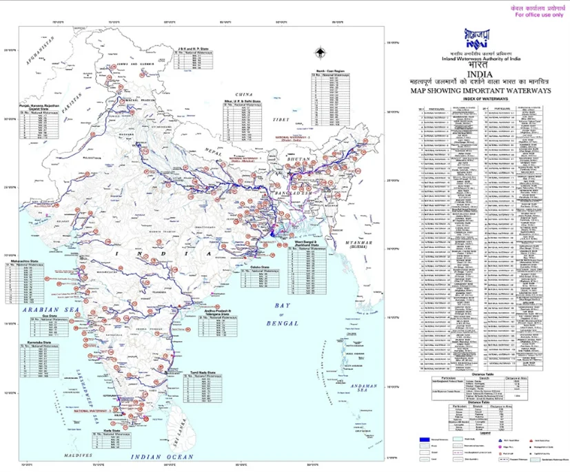
Image source: Maps of India
- Centre and State powers over Water Resources
- Linking Rivers
For a dedicated peer group, Motivation & Quick updates, Join our official telegram channel – https://t.me/IASbabaOfficialAccount
Subscribe to our YouTube Channel HERE to watch Explainer Videos, Strategy Sessions, Toppers Talks & many more…

Related Posts :
Telecom regulatory authority of india, need for stronger mental health strategy.

- DAILY CURRENT AFFAIRS IAS | UPSC Prelims and Mains Exam – 8th April 2024
- UPSC Quiz – 2024 : IASbaba’s Daily Current Affairs Quiz 8th April 2024
- [DAY 30] 60 DAY RAPID REVISION (RaRe) SERIES for UPSC Prelims 2024 – GEOGRAPHY, CURRENT AFFAIRS & CSAT TEST SERIES!
- DAILY CURRENT AFFAIRS IAS | UPSC Prelims and Mains Exam – 5th April 2024
- UPSC Quiz – 2024 : IASbaba’s Daily Current Affairs Quiz 6th April 2024
- [DAY 30] 60 DAY RAPID REVISION (RaRe) SERIES for UPSC Prelims 2024 – ENVIRONMENT, CURRENT AFFAIRS & CSAT TEST SERIES!
- UPSC Quiz – 2024 : IASbaba’s Daily Current Affairs Quiz 5th April 2024
- [DAY 29] 60 DAY RAPID REVISION (RaRe) SERIES for UPSC Prelims 2024 – SCIENCE AND TECHNOLOGY, CURRENT AFFAIRS & CSAT TEST SERIES!
- [New Batch] KPSC/KAS 2024 Prelims Crash Course – ‘Mission ಸಂಕಲ್ಪ’ Crack Prelims in 60 Days Starts 12th April | Available ONLINE!
Don’t lose out on any important Post and Update. Learn everyday with Experts!!
Email Address
Search now.....
Sign up to receive regular updates.
Sign Up Now !

Essay on Transport in India
Students are often asked to write an essay on Transport in India in their schools and colleges. And if you’re also looking for the same, we have created 100-word, 250-word, and 500-word essays on the topic.
Let’s take a look…
100 Words Essay on Transport in India
Introduction.
India’s transport system is vast and diverse, providing critical connectivity. It includes several modes like road, rail, air, and water transport.
Road Transport
Roads are the most common form of transport in India. They connect cities, towns, and villages, facilitating the movement of people and goods.
Rail Transport
India has one of the largest railway networks globally, serving millions daily. Trains are a popular and affordable means of long-distance travel.
Air and Water Transport
Air travel is fastest, while waterways are used for transporting heavy goods. Both play a crucial role in India’s transport system.
250 Words Essay on Transport in India
India, a vast country with diverse geographical features, has a complex and multifaceted transportation system. The transport infrastructure includes an extensive network of roads, railways, airways, and waterways, connecting its teeming population and facilitating economic growth.
Road transport is the backbone of India’s transport system, accounting for about 70% of freight and 90% of passenger traffic. The National Highway Development Project has significantly enhanced connectivity. However, challenges like traffic congestion, inadequate maintenance, and high accident rates persist.
The Indian Railways, the fourth largest rail network globally, is a vital component of the national economy. Despite its extensive reach, capacity constraints, outdated technology, and operational inefficiencies hinder its potential.
With increasing urbanization and economic development, air transport has gained prominence. India’s aviation sector, however, faces issues like high operational costs and infrastructural bottlenecks. On the other hand, water transport, despite being environmentally friendly and cost-effective, remains underutilized due to inadequate infrastructure.
Future of Transport in India
The future of transport in India hinges on sustainable, technology-driven solutions. Initiatives like the Smart Cities Mission and the introduction of high-speed trains and electric vehicles indicate a shift towards innovative, eco-friendly transport systems. Nevertheless, comprehensive planning, significant investment, and effective policy implementation are crucial for realizing this vision.
Transportation in India, while expansive and diverse, requires significant improvements to meet the growing demands of its population and economy. By embracing innovation and sustainability, India can transform its transport sector, enhancing connectivity, and fostering inclusive growth.
500 Words Essay on Transport in India
India, with its vast and diverse geography, presents a unique transportation challenge. The country’s transport system is a key component of its socio-economic framework, with a direct impact on both urban and rural communities. The transport infrastructure in India includes an extensive network of roads, railways, airways, and waterways that connect the country’s length and breadth.
Road transport is the backbone of India’s transportation system, accounting for about 70% of the country’s goods traffic and nearly 90% of passenger traffic. The country boasts the world’s second-largest road network, spanning more than 5.5 million kilometers. However, the condition of Indian roads varies widely, with highways and city roads often being in better shape than rural roads. The government has launched various initiatives like the Pradhan Mantri Gram Sadak Yojana (PMGSY) and Bharatmala Pariyojana to improve rural connectivity and augment national highways.
Railway Transport
The Indian Railways, the fourth largest rail network globally, plays a crucial role in connecting different regions of the country. It not only serves as a vital mode of transport for passengers but also facilitates the movement of goods across the country. The Indian Railways has been undergoing significant transformation with the introduction of high-speed trains, dedicated freight corridors, and the digitization of ticketing services.
Air Transport
Air transport in India has witnessed exponential growth in recent years, making it the world’s third-largest civil aviation market. The government’s UDAN (Ude Desh ka Aam Naagrik) scheme aims to make air travel affordable and widespread, connecting smaller towns and cities. However, issues such as high operational costs and infrastructural bottlenecks need to be addressed for sustainable growth.
Water Transport
India, with a coastline of over 7500 kilometers and significant inland water resources, has immense potential for water transport. However, this mode remains underutilized due to lack of modern infrastructure and policy focus. The recent Sagarmala initiative aims to promote port-led development and harness the potential of waterways.
Challenges and Future Prospects
Despite significant strides, India’s transport system faces challenges like inadequate infrastructure, traffic congestion, pollution, and safety concerns. The need of the hour is to develop sustainable and smart transportation systems. The government’s focus on infrastructure development, promotion of electric vehicles, and initiatives like Smart Cities Mission and Make in India are positive steps towards this direction.
In conclusion, India’s transport system, with its vast and diverse network, plays a pivotal role in the country’s socio-economic development. While challenges persist, the future holds immense potential for transformation, driven by policy initiatives, technological advancements, and a focus on sustainable practices.
That’s it! I hope the essay helped you.
If you’re looking for more, here are essays on other interesting topics:
- Essay on Transgender in India
- Essay on Startups in India
- Essay on Social Movements in India
Apart from these, you can look at all the essays by clicking here .
Happy studying!
Leave a Reply Cancel reply
Your email address will not be published. Required fields are marked *
Save my name, email, and website in this browser for the next time I comment.
Home — Essay Samples — Geography & Travel — India — Waterways in India
Waterways in India
- Categories: India
About this sample

Words: 1340 |
Published: Feb 12, 2019
Words: 1340 | Pages: 3 | 7 min read
- A ban on dredging in protected habitat area
- In other areas that are known to be the habitat of valued aquatic species, no dredging will be allowed in the breeding seasons
- The speed of barges travelling in the protected areas of the sanctuaries will be restricted to 5km per hour
- All vessels plying on the Ganga will be fitted with noise control system and animal exclusion devices so that aquatic life is not unduly disturbed
- All vessels will also have to comply with ‘zero discharge’ standards to prevent solid or liquid waste from flowing into the river and affecting its biodiversity

Cite this Essay
Let us write you an essay from scratch
- 450+ experts on 30 subjects ready to help
- Custom essay delivered in as few as 3 hours
Get high-quality help

Prof Ernest (PhD)
Verified writer
- Expert in: Geography & Travel

+ 120 experts online
By clicking “Check Writers’ Offers”, you agree to our terms of service and privacy policy . We’ll occasionally send you promo and account related email
No need to pay just yet!
Related Essays
7 pages / 3064 words
4 pages / 1692 words
2 pages / 1096 words
3 pages / 1321 words
Remember! This is just a sample.
You can get your custom paper by one of our expert writers.
121 writers online

Still can’t find what you need?
Browse our vast selection of original essay samples, each expertly formatted and styled
Related Essays on India
India has to take urgent steps to manage its water resources in scientific and efficient way otherwise there will be very adverse effects on all sectors which include agriculture, industries, health sectors etc. More than half [...]
The paper reviews one of the most important question that is being asked about the doctrine of separation of power in India and whether the powers of the three bodies of the Government i.e. legislature, executive, and judiciary [...]
The word materiovigilance is a combination of two words – ‘material’ which means ‘a physical substance that things can be made from’ and ‘vigilance’ which means ‘more careful attention, especially in order to notice possible [...]
Rule of Law has always been championed as one of the building blocks on which the modern society rests. Derived from the French phrase ‘La Principe de Legality', which translates to the principle of legality, it refers to a [...]
The way Ahead Goods and Service Tax (GST) was rolled out in India on July 1st 2017, after several rounds of dead lock in the parliament. Observers have described the reform as the most meaningful change to India’s tax regima [...]
Syed Nasir Raza Kazmi was a renowned Urdu poet of Pakistan. He should be ranked among those of our writers who were not destined to live long but who, during their limited span, wrote extensively and touched the heights of [...]
Related Topics
By clicking “Send”, you agree to our Terms of service and Privacy statement . We will occasionally send you account related emails.
Where do you want us to send this sample?
By clicking “Continue”, you agree to our terms of service and privacy policy.
Be careful. This essay is not unique
This essay was donated by a student and is likely to have been used and submitted before
Download this Sample
Free samples may contain mistakes and not unique parts
Sorry, we could not paraphrase this essay. Our professional writers can rewrite it and get you a unique paper.
Please check your inbox.
We can write you a custom essay that will follow your exact instructions and meet the deadlines. Let's fix your grades together!
Get Your Personalized Essay in 3 Hours or Less!
We use cookies to personalyze your web-site experience. By continuing we’ll assume you board with our cookie policy .
- Instructions Followed To The Letter
- Deadlines Met At Every Stage
- Unique And Plagiarism Free
We've detected unusual activity from your computer network
To continue, please click the box below to let us know you're not a robot.
Why did this happen?
Please make sure your browser supports JavaScript and cookies and that you are not blocking them from loading. For more information you can review our Terms of Service and Cookie Policy .
For inquiries related to this message please contact our support team and provide the reference ID below.
- Class 6 Hindi
- Class 6 English
- Class 6 Maths
- Class 6 Science
- Class 7science
- Class 7 Maths
- Class 7 English
- Class 7th: Supplementary Reader English
- Class 7 Hindi
- Class 7 Social Science
- Class 7 Sanskrit
- Class 8 Social Science
- class 8 science
- Class 8 Maths
- Class 8 Honeydew
- Class 8: It So Happened
- Class 9 English
- Class 9 Maths
- Class 9 Science
- Class 9 Social Science
- Class 9 in Hindi Medium
- RD Sharma Class 10 Maths
- class 10 science
- Class 10 English
- Class 10th Sanskrit
- Class 10 Foundation of Information Technology
- Class 10 Social Science
- Class 10 Hindi Sanchayan
- Class 10 Hindi Sparsh
- Class 10 Hindi Kshitij
- Class 10 Hindi Kritika
- Class 11 Maths
- Class 11 Chemistry
- Class 11 Physics
- Class 11 Biology
- Class 11 Python
- TS Grewal Accountancy
- Class 11 Business Studies
- Class 11 Psychology
- Class 11 Economics
- Class 12 Physics
- Class 12 Chemistry
- Class 12 Biology
- Class 12 (Python)
- Class 12 (C++)
- NCERT Accountancy
- Class 12 Business Studies
- Class 12 Entrepreneurship
- Class 12 History
- Class 12 Political Science
- Class 12 Psychology
- Class 12 Sociology
- Class 12 English Vistas
- Class 12th English Flamingo
- Class 12th maths
- Class 12 Micro Economics
- Class 12 Macro Economics
- एस.एस.सी. सीजीएल
- करेंट अफेयर्स
- करेंट अफेयर्स प्रश्नोत्तरी
- GK in Hindi
- प्राचीन भारतीय इतिहास
- मध्यकालीन भारतीय इतिहास
- Advance Maths
- CHART PAPER
- KIDS ALL IN ONE
Transport System in India (Railways, Roads, Waterways and Airways) essay
Transport system in india (railways, roads, waterways, and airways), transport system in india.
The most important means of transportation in a country are roads, railways, airways, and waterways. India has completely revolutionized its transportation system, both external and internal.
Rail Transport
Railways are the most important means of transportation in India. The improvement in railway communications in recent times has played a most important part in the internal development of the country. They have brought the different parts of the country closer.
The advent of the railway has been of special advantage to the peasantry. Social and political influences from railway construction have been no less.
Advantages of Railways
- Travelling has become cheaper;
- Defense of the country is less difficult.
- Greater peace and order is maintained in the country, and
- The spirit of nationalism has very greatly developed.
Road Transport
India has a vast network of roads, both metalled and unmetalled. However, this means of transport and communication are still inadequate for our needs. The vehicles that are mainly used on village roads are motorbuses, trucks, and bullock carts.
Before the advent of railways, roads were the only means of communication for the exportation of surplus produce. With the extension of the railway system, it has become more and more necessary to construct roads to feed the railways.
At present, the economic loss caused by the inaccessibility of many agricultural districts in the rainy season is very great. In sandy, hilly, and forest-covered tracts and in other parts of the country, where railways have not penetrated, road transport still holds an important share of long-distance traffic.
The opening of railways has created a demand for road-construction, which must be met by the local and provincial bodies. The question of developing the roads is also of vital importance. We cannot expect any significant progress in our rural economy unless there are good road connections between villages and towns.
Water transport is the oldest and cheapest form of transport. It is one of the most important external and internal means of transport in all the civilized countries of the world. It is useful for the carriage of bulky and heavy goods.
In India, we have many great river systems. However, they are unevenly distributed, some of them are fully utilized for irrigation purposes, and some others are naturally unfit for navigation.
In some parts of India, however, waterways are still extensively used for navigation purposes.
In India, more navigable rivers and canals should be made. And, a systematic policy for the development of the inland water transport should be pursued.
The question of shipping has also great importance in a country like India with a large coastline.
Air Transport System
Proper attention must also be given at the same time to air transport as another means of national and international communication. India possesses some natural advantages in this respect and they have to be fully exploited for development of airways.
The Government is taking a keen interest in the expansion of civil aviation not only for its importance as a means of transport but also because of its strategic value in the matter of national defense. There are also a large number of aerodromes in the country.
An analytic study of the above facts justifies the conclusion that the transport system of India is making good progress. The Government is providing all reasonable facilities for the development of the country’s transport. It is for the people to take advantage of the facilities offered and to step up the country’s progress in the way we desire. Millions of tons of raw materials and finished goods have to be transported over long distances and in the absence of transport facilities there will be bottlenecks in the transport of goods leading to undesirable consequences.
Share this:
- Click to share on Twitter (Opens in new window)
- Click to share on Facebook (Opens in new window)
Leave a Reply Cancel reply
Your email address will not be published. Required fields are marked *
Notify me of follow-up comments by email.
Notify me of new posts by email.
NCERT & CBSE ALL SUBJECT
Recent posts.
- What is Animation?
- Equivalence Relation on Set (advance math)
- Transitive Relation on Set (advance math)
- Anti-symmetric Relation on Set (advance math)
- Symmetric Relation on Set (advance math)
- Advance math
- Class 10 Science
- Class 11 Accountancy
- Class 11 Computer Science (Python)
- Class 11 Math
- Class 12 Accountancy
- Class 12th English
- Class 6th Sanskrit
- Class 7 Hindi Textbook – हिंदी वसंत भाग-II
- Class 7 Science
- Class 7: An Alien Hand Supplementary Reader
- Class 8 Science
- Class 8th maths
- Class 9 English Beehive
- english letter writing
- Hindi and English
- Hindi Nibandh Lekhan हिंदी निबंध लेखन
- Important Questions for Class 12 Computer Science (Python)
- NCERT Solutions for Class 12 Computer Science (C++)
- NCERT Solutions For Class 7 Honeycomb English
- NCERT Solutions For Class 8 Honeydew – All Chapters
- NCERT Solutions for Class 8 Social Science
- NCERT Solutions For Class 8: It So Happened – All Chapters
- RD Sharma Class 10
- RD Sharma Solutions Class 12 Maths
- SSC CGL English Comprehension
- SSC CGL General Awareness
- SSC CGL Quantitative Aptitude
- Tally ERP 9
- Uncategorised
- Vistas-English 12th
- आधुनिक भारत का इतिहास
- ऋतुओं पर निबंध (Essay On Seasons In Hindi)
- त्योहारों पर निबंध (Essay On Festivals In Hindi)
- दिवसों पर निबंध (Essay On Days In Hindi)
- नेताओं पर निबन्ध (Essay On Leaders In Hindi)
- पर्यावरण सामान्य ज्ञान
- भारतीय राजव्यवस्था
- भारतीय संस्कृति
- विज्ञान पर निबंध (Essay On Science In Hindi)
- स्वास्थ्य और खेल संबंधी निबंध (Essay On Health And Sports In Hindi)
© 2024 indianexpresss.in
IMAGES
VIDEO
COMMENTS
Short essay on Water Transport system in India. Water transport is one of the oldest means of transport in India. Prior to the advent of rail and road transports, goods and people were moved from one place to another through water transport. Since there is almost very small cost involved in the construction and maintenance of waterways this ...
Benefits of waterways transport. The cost of water transport in India is roughly 50 paise (0.63¢ US) a kilometre, as compared to ₹1 (1.3¢ US) by railways and ₹1.5 (1.9¢ US) by roads. [2] Water transport has received significant attention in recent times [timeframe?] as logistical costs in India are some of the highest among major ...
Water transport in India. Water transport is the cheapest and the oldest mode of transport. It operates on a natural track and hence does not require huge capital investment in the construction and maintenance of its track except in case of canals. The cost of operation of water transport is also very less. It has the largest carrying capacity ...
India is endowed with various Inland Water Transport (IWT) options that comprise rivers, canals, backwaters, creeks, and tidal inlets. India has over 5,000 km of navigable inland waterways under development. These not only form a competitive alternative mode of transportation with lower operating cost (30% lower than the railways and 60% lower ...
Developing India's First Modern Inland Waterway. April 12, 2017. World Bank. Through the ages, rivers have served as effective waterways, carrying people and goods over long distances. Even today, many countries depend heavily on inland water transport, especially for large and bulky cargo, as it is cheaper, more reliable and less polluting ...
Inland water transportation is the system of transport through all navigable man-made canals, lakes and rivers. Several large rivers in various parts of the world are used by barges
Related Papers. Viability of Inland Water Transport in India. ... Sriraman (2010) "Long term perspectives on Inland Water transport in India" RITES Journal, Statistics of Inland Water Transport 2011-12, Transport Research Wing, Ministry of Shipping, Government of India, New Delhi UNCTAD [United Nations Conference on Trade and Development ...
Cost effective: According to World Bank, inland waterways in India can be up to 60% cheaper than road transport and 20-30% cheaper than rail transport. Fuel efficiency: It consumes approximately 0.1 liters of fuel per ton-kilometer, while road transport consumes around 2.5 liters and rail transport consumes around 0.6 liters.
registered a growth of 5.9 per cent in 2014-15, and India aims to grow further in this sector. Revitalizing Project 'Sagarmala' in 2014 is a major step towards India's infrastructural growth. It constitutes a series of sub-projects aimed to boost India's port infrastructure development along the coastline.
It has some importance in Orissa, Tamil Nadu and Andhra Pradesh. In 1986, Inland Waterways Authority of India was set up. 2. Coastal Transport: India has wide coast line of nearly 4200 miles. Transport facilities available along the vast coast line of the country through ships is called coastal shipping.
Inland waterways have played an important role in the Indian transport system since ancient times. However, in the decades after independence, the importance of this mode of transport has declined considerably with the expansion of road and rail transport. Nevertheless, there is a growing realization that inland water transport has to be an integral component of the overall transport system of ...
India has about 14500 kilometres of navigable waterways, although they only contribute to around 1% of the country's transportation. Canal backwaters, rivers, and creeks, among many other sorts of water bodies, are included. Although 3700 km of major rivers are navigable by mechanised flat bottom vessels, only 2000 km are currently utilised.
National Waterway-2 (NW-2) is an 891 km-long waterway that runs along the Brahmaputra River from Dhubri in Assam to Sadiya in Arunachal Pradesh. It is the second-longest inland waterway in India ...
In this essay we will discuss about water transport and its forms. Water transport probably developed before the use of animals and greatly aided hunters and fishermen in their activities because waterways formed an easy means of travel in places where dense forests on land hindered movement. Waterways have, for this reason, often formed ...
PDF | On Mar 17, 2021, Ar.Deepali K.Hejib and others published Inland Water Transportation in India: Past, Present and Future (Theme: Transportation Planning) | Find, read and cite all the ...
The inland water transport is a cheap, fuel-efficient, environment-friendly mode with a higher employment generation potential and is suitable for heavy and bulky goods. But, the share of inland water transport in total transport in India is only around 3.5 per cent. Status of inland water transport:
The results facilitate the decisions of policymakers by focusing on the key influential barriers to IWTs in India. 3. Barriers of inland water transportation. Asia-Pacific countries possess an extensive system of water bodies that make them naturally equipped to handle water transport.
Inland water transport refers to the transportation of people, goods, and materials via waterways such as rivers, canals, lakes, and other navigable bodies of water that are located within a country's boundaries. IWT is the most economical mode of transportation, especially for bulk cargo like coal, iron ore, cement, food grains and fertilizer.
500 Words Essay on Water Transport Introduction. Water transport, one of the oldest means of conveyance, has been instrumental in shaping human civilization by facilitating trade, exploration, and cultural exchange. It is a mode of transportation that involves moving goods and people over bodies of water such as oceans, rivers, canals, and ...
500 Words Essay on Transport in India ... Water Transport. India, with a coastline of over 7500 kilometers and significant inland water resources, has immense potential for water transport. However, this mode remains underutilized due to lack of modern infrastructure and policy focus. The recent Sagarmala initiative aims to promote port-led ...
As we know now, India has an extensive inland waterways network of 14,500KMs. Through times, rivers have been efficient and effective for carrying load over long distances. Even in today's time, many countries depend heavily on inland waterways for transport of large and bulky cargo. Talking economy, the inland waterways are much cheaper and ...
Essay on "The Water Transport System in India" - (1301 Words) Shipping plays an important role in the transport sector of India's economy. Approximately, 95 per cent of the country's trade by volume (70 per cent in terms of value) in moved by sea. India has the largest merchant shipping fleet among the developing countries and ranks ...
India's Most Innovative Cities Are Running Out of Water. Tech professionals are fleeing a drought in the IT hub of Bengaluru. Fixing the issue means confronting the country's two most ...
Water transport is the oldest and cheapest form of transport. It is one of the most important external and internal means of transport in all the civilized countries of the world. It is useful for the carriage of bulky and heavy goods. In India, we have many great river systems. However, they are unevenly distributed, some of them are fully ...